Noise Node
- Category: Base Shape
- Edition: All editions
- Output type: Height / Mask
- Typical place in a graph: the first node, the base shape everything else builds on
Noise creates natural land from nothing: rolling hills, mountain massifs, sharp ridges, mounds or dunes. It stacks several layers of random bumps, from large landforms down to small surface detail, and gives you control over how big, how rough and how sharp the result is. It is also one of the best sources of natural variation for masks, texture blending and spawn density.
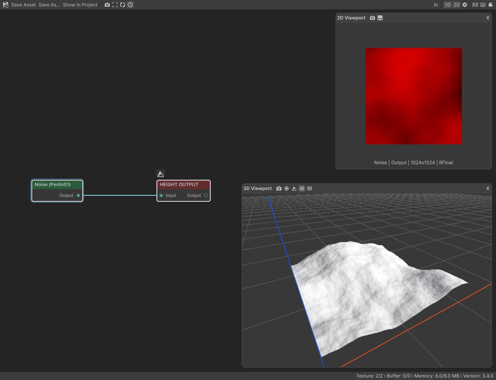
When to use it
- Start a terrain: connect Noise to Height Output and you have hills or mountains straight away.
- Make the landform character: rounded massifs (Perlin 01), alpine crests (Ridged), creased mounds (Billow).
- Add variation to anything else: multiply a mask by a Noise to break up a texture layer, or to make grass and trees thin out unevenly.
- Vary another shape: multiply detailed mountains by a smooth Noise with only one layer so neighboring peaks reach different heights.
- Make mesas and terraced cliffs with the Remap curve.
- Not for: one specific feature in one place, such as a single volcano or crater (use Volcano, Crater or Shape), or patterns of cells such as cracked plates (use Voronoi).
Inputs
None. Noise generates its result from its settings and from where the biome is.
Outputs
| Slot | Type | What it holds |
|---|---|---|
| Output | Mask | The land shape. 0 is the terrain floor and 1 is the full terrain height (the Vista Manager's Max Height). Most modes stay roughly between 0 and 1; Perlin Raw, Billow and Open Simplex can dip below 0, and those parts end up on the floor. With a Remap curve that stays between 0 and 1 (as the default does), values never go above 1. |
Properties
Pattern
| Property | Default | Range | What it does on the terrain |
|---|---|---|---|
| Mode | Perlin 01 | See Modes | The character of the land: rounded, ridged, creased, or with stronger contrast. |
| Offset | 0, 0 | Any, meters | Slides the pattern across the terrain to use another part of it. The character stays the same; only which hills land where changes. |
| Scale | 750 | Any positive value, meters | The size of the largest landforms. Raise it for fewer, bigger, gentler mountains; lower it for many small, steep hills. 600 to 750 gives natural mountains on any biome size. |
| Lacunarity | 2.25 | 1 and up | How much finer each detail layer is than the one before. At 2.25, each layer's bumps are 2.25 times smaller. Higher values jump quickly from the big shape to fine grain, with little in between. Values close to 1 stack bumps of similar size. |
| Persistence | 0.335 | 0.01 to 1 | How strong each finer layer is compared with the one before. Low values keep slopes smooth with only a little surface texture; high values give rough, rocky ground all over. |
| Layer Count | 8 | 1 to 10 | How many detail layers are stacked. 1 gives one smooth wave; 3 adds gentle undulation; 8 adds bumps down to boulder size. |
| Seed | Random | Any integer | Picks another random pattern with the same character. |
| Layer Derivative | Linear | Linear, Pow | How quickly the layers shrink. Linear: every layer is smaller and weaker by the same step, so there is detail at every size. Pow: each step is bigger than the last, so fine detail fades out after a few layers and the surface stays smooth. |
| Flip Sign | On | On, Off | Adds and subtracts the detail layers in turn, which keeps the land balanced inside the height range. Turn it off and every layer adds on top: the whole land rises, and with rough settings it flattens into a plateau at full height. See the warning below. |
Warp
| Property | Default | Range | What it does on the terrain |
|---|---|---|---|
| Mode | None | None, Angular, Directional | Distorts the land. Angular folds and swirls the hills, like contorted rock layers. Directional pushes the surface along its own slopes, for a chipped, craggy look. |
| Min Angle, Max Angle | -360, 360 | -360 to 360 degrees | Angular only. The range of directions the warp pushes the land. The full range folds the most. A narrow range pushes everything roughly the same way, which mostly slides the pattern and folds it much less. |
| Intensity | 1 | Any | How far the warp pushes. The useful values differ a lot between modes: Angular needs about 50 for gentle folds and 200 for strong swirls (1 has no visible effect). Directional looks craggy at 5 to 20 and breaks into static above about 50. |
Remap
| Property | Default | Range | What it does on the terrain |
|---|---|---|---|
| Remap | Straight line | Curve from 0 to 1 | Reshapes the heights. The horizontal axis is the noise from low to high, the vertical axis is the height that comes out. Flatten the start of the curve to widen the valley floors; lower the end to cap the peaks; a steep S curve turns hills into mesas with flat tops and cliffs. |
| Apply Per Layer | On | On, Off | Applies Remap to every detail layer as well as the final result. On: the reshaping repeats at every size, so an S curve gives broken, stepped, terraced cliffs. Off: only the final land is reshaped, for one clean form. With a straight line curve this setting changes nothing. |
Common properties
| Property | What it does |
|---|---|
| Id | The node's unique name in this graph, shown for reference. You cannot edit it. Scripts and the AI workflow CLI use it to find the node. |
| Resolution | How detailed this node's result is, in texels across the biome. Noise has no input, so Relative To Main Input (default) and Relative To Graph both follow the biome's Canvas Resolution, times the multiplier below. Absolute sets an exact size. Higher resolution keeps narrow ridges and small bumps sharp but costs more memory and time; lower resolution is a cheap way to make soft shapes at a large scale, such as a mask that only drives variation. Absolute is limited to 32 to 512 in Vista Personal and 32 to 4096 in Vista Indie and Pro. |
| Split Execution | Lets this node run over several frames so the editor stays responsive during long generations. It only works when Allow Split Execution is on in the graph settings. Noise finishes in one step, so splitting only adds a short pause around it; leave it off. |
| Bypass | Skips the node. Noise has no input to pass through, so nothing comes out, and the nodes after it receive empty, flat ground. |
How the land is built
Noise starts with one layer of large, smooth bumps the size of Scale. It then adds a second layer that is Lacunarity times smaller and Persistence times weaker, then a third that is smaller and weaker again, and so on for Layer Count layers. The big layers decide where the mountains and valleys are; the small layers add the ridges, gullies and surface roughness on top.
So, as a rule of thumb:
- Scale sets the size of the land.
- Layer Count sets how much detail there is.
- Persistence sets how strong that detail is.
- Lacunarity sets how quickly the detail gets fine.
The pattern is laid out in meters, in world space. Two biomes or two terrain tiles next to each other with the same Noise settings line up seamlessly, and a Noise with Scale 750 gives the same size of mountains on a 1 km biome as on a 4 km one. Moving a biome reveals a different part of the pattern instead of carrying the hills with it. If you want the land to move with the biome, set the biome's Space to Local.
Examples
All examples use the sample graph Noise → Height Output, on a 1024 × 1024 m biome with a terrain height of 400 m. The values not listed are the defaults, with Seed 128. The 2D view shows the output from black (floor) to red (full height). The 3D view shows the terrain.
Default settings: rolling mountains
| Property | Value |
|---|---|
| (all defaults) | Scale 750, 8 layers, Persistence 0.335 |


With the defaults, a 1 km biome holds about one large massif and its foothills, with fine detail across the surface. This is a good start for most mountain terrains; erosion turns it into something believable.
Smaller scale: many steep hills
| Property | Value |
|---|---|
| Scale | 250 |


A third of the scale packs about nine times as many hills into the same area. Because the height stays the same, the slopes get much steeper, almost cliffs. For small hills that still look natural, lower the height too (with Levels or the Vista Manager's Max Height).
One layer: a single smooth wave
| Property | Value |
|---|---|
| Layer Count | 1 |

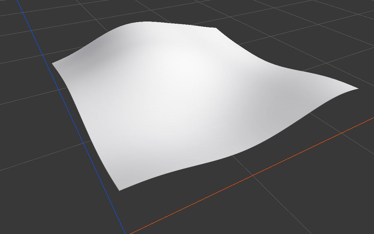
Only the largest layer remains. On its own it is too smooth for land, but it is very useful to vary other shapes: multiply your mountains by it in Combine so some peaks rise higher than others, or use it to fade a texture or forest across the map.
High persistence: rough, rocky ground
| Property | Value |
|---|---|
| Persistence | 0.6 |
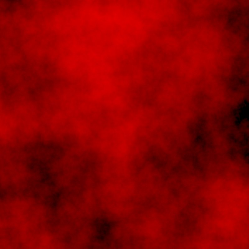
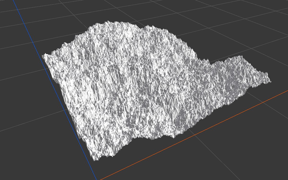
The fine layers are now almost as strong as the large ones, so roughness covers everything, valleys included. Use it in small doses: for a rocky mask, or blended in where the ground should look broken.
Larger lacunarity: detail jumps to fine grain
| Property | Value |
|---|---|
| Lacunarity | 3.5 |
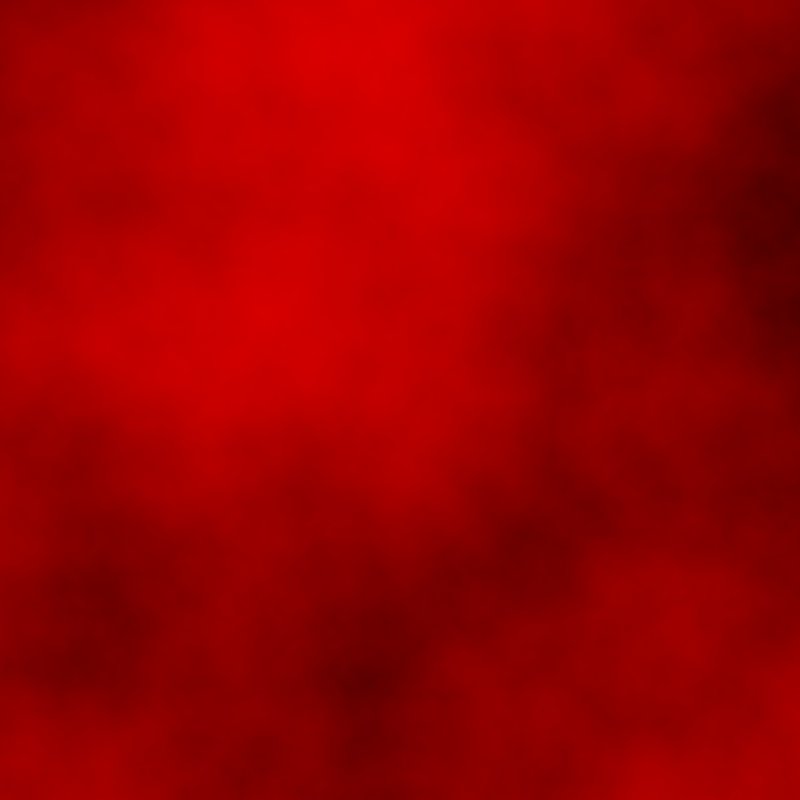
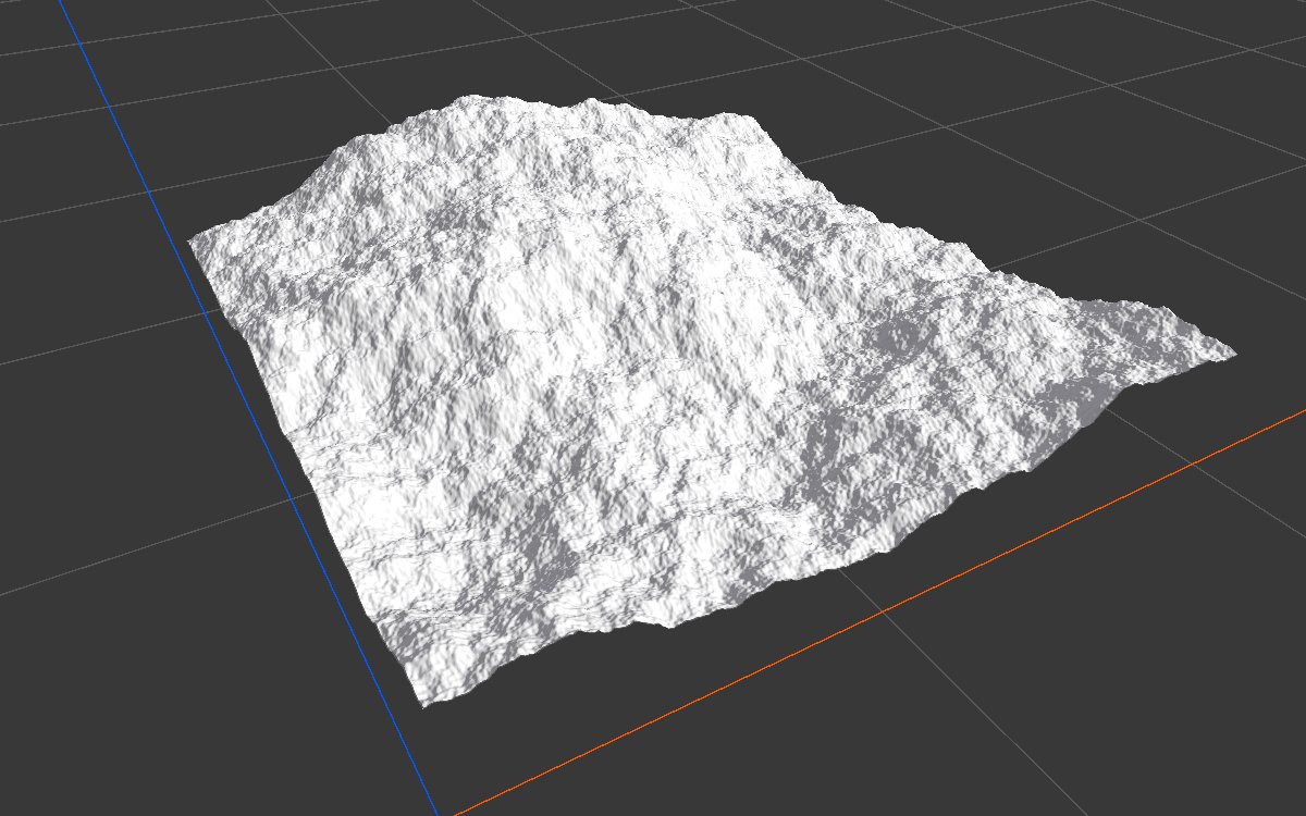
Each layer is now 3.5 times finer than the last, so after the big shape the detail quickly turns into a fine, gritty texture. There are fewer ridges of medium size in between.
Pow derivative: smooth surface
| Property | Value |
|---|---|
| Layer Derivative | Pow |


The layers shrink faster each time, so after two or three layers the rest are too small and weak to see. Even with 8 layers, the land stays smooth, like soft, rounded hills or mountains covered in snow.
Modes
The same settings with each Mode, at Scale 500 so the character is easier to see.
| Mode | 2D | 3D | Character |
|---|---|---|---|
| Perlin 01 |  |
 |
Rounded hills and massifs. The usual choice for mountains and the default. |
| Perlin Raw |  |
 |
The same pattern, centered on 0 instead of 0.5. About a third of the land falls below 0 and lies flat on the floor, so hills rise out of flat lowland. Useful for islands, or hills scattered over a plain. |
| Billow |  |
 |
Rounded mounds that meet in sharp creases at the bottom. Good for rolling hills, mounds, and puffy masks that look like clouds. It sits low in the height range. |
| Ridged |  |
 |
The opposite of Billow: sharp crests at the top and rounded valleys. Gives alpine ridges and arêtes. It sits high in the height range. |
| Open Simplex |  |
 |
A different noise with stronger contrast: taller peaks and deeper pockets than Perlin 01, reaching almost the full height range. |
Warp
The same settings at Scale 400, without and with warp.
| Warp | 2D | 3D | Look |
|---|---|---|---|
| None |  |
 |
The plain pattern, for comparison. |
| Angular, Intensity 50 | 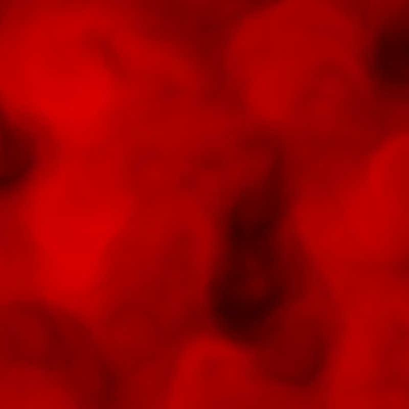 |
 |
The hills start to fold and twist. Their outlines look less round and more geological. |
| Angular, Intensity 200 | 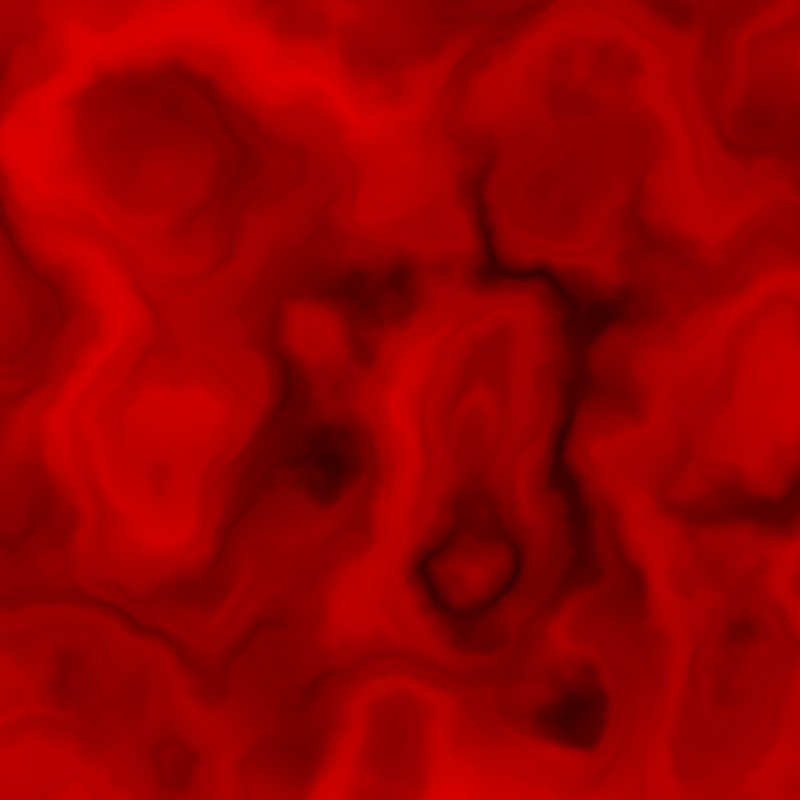 |
 |
Strong swirls, like contorted rock strata or alien land. |
| Directional, Intensity 10 |  |
 |
The surface breaks into small facets, like chipped rock or crags. |
| Directional, Intensity 60 |  |
 |
Too strong: the surface shreds into static. Keep Directional below about 30. |
Remap: mesas and terraced cliffs
| Property | Value |
|---|---|
| Remap | S curve: flat near 0, a steep rise around 0.3 to 0.45, then flat again up to 0.7 |
| Apply Per Layer | On, then Off |
Apply Per Layer on:


Apply Per Layer off:


The steep part of the curve turns the slopes into cliffs, and the flat parts become valley floors and plateau tops. With Apply Per Layer on, the small layers are stepped too, so the cliffs break into ledges and terraces. With it off, the result is one clean mesa. Erosion afterwards makes either look weathered.
Flip Sign off (what to avoid)
| Property | Value |
|---|---|
| Persistence | 0.6 |
| Flip Sign | Off |

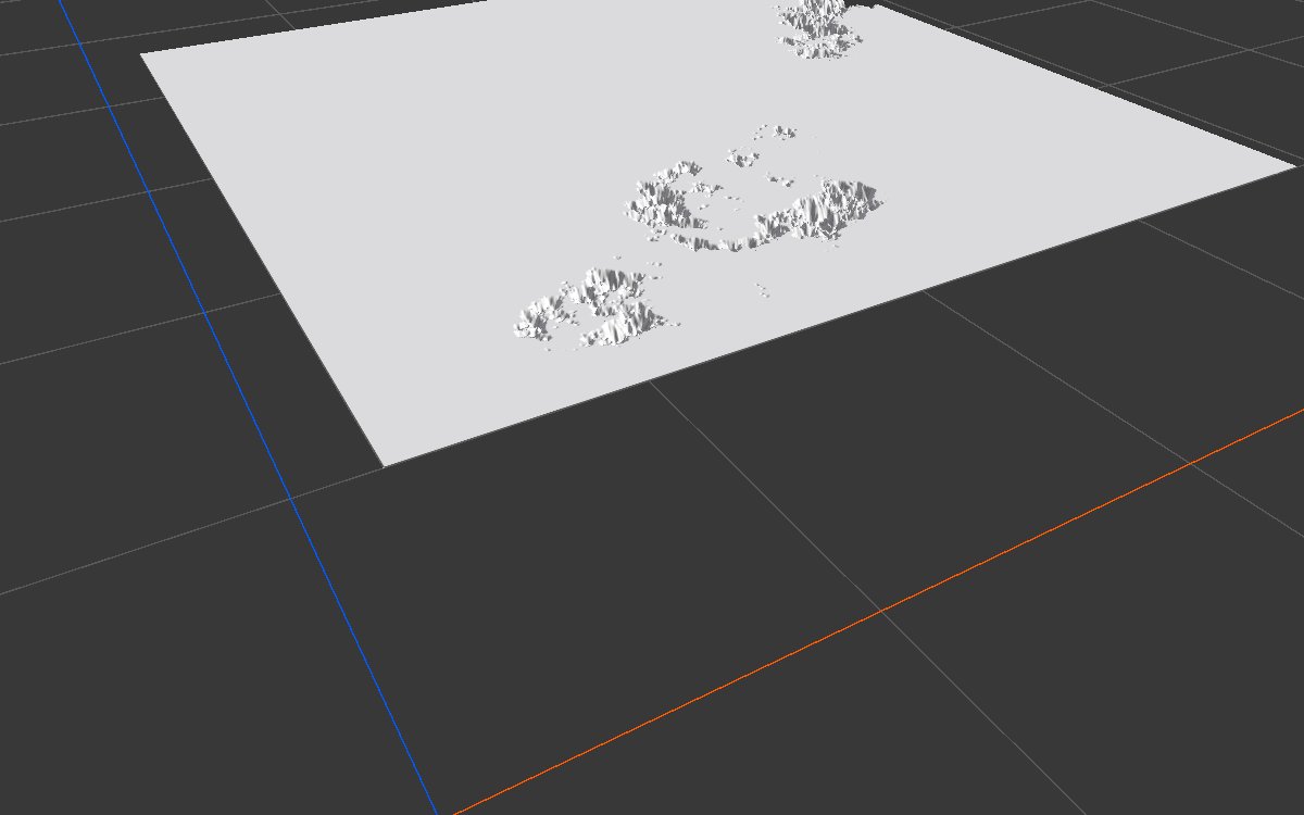
With every layer adding on top, the land climbs past full height and is cut flat there. Even with default settings, turning Flip Sign off lifts the lowest point to about half the terrain height.
Recipes
- Natural mountains: Noise (Perlin 01, Scale 700, 8 layers, Remap starting at (0.1, 0) for wider valleys) × a second Noise (1 layer, Scale about 1.3 × the first, a different seed) in Combine (Multiply) → Levels to lift the floor slightly above zero. The second noise makes the peaks reach different heights. Follow with Hydraulic Erosion 2 for a weathered look. The AI workflow recipe
mountain-base-shapedescribes it step by step. - Sand dunes: two Noise nodes (Perlin 01, 2 layers, Scale 200 and 150, different seeds) → Levels (Out High about 0.15 each) → Combine (Min) for sharp crests → Thermal Erosion 3. Recipe
dunes-geometry. - Break up a texture or forest: your mask × Noise (Scale about 200, Persistence about 0.7, Remap starting at about 0.13 so it dims without erasing) in Combine (Multiply).
- Ragged mesa edges: a fine Noise (Scale 100) drives an Angular Warp on the mesa shape. Recipe
mesa-geometry.
Tip
Match Scale to what you want, not to the biome size. Mountains look natural around 600 to 750, hills around 200 to 400, and fine variation for masks around 50 to 200.
Tip
When you combine two Noise nodes, give them different seeds, and use an uneven scale ratio such as 0.75 or 1.3. The same seed gives the same pattern, so combining adds nothing; neat ratios like 0.5 or 2 line the patterns up and look artificial.
Note
The node's Seed is combined with the biome's Seed. Changing the biome seed changes every Noise in its graph, which is an easy way to get a new variation of the whole terrain.
Note
The pattern is in world space by default (see How the land is built). If the hills jump when you move a biome, that is expected; set the biome's Space to Local to keep them attached to it.
Note
With Perlin Raw, Billow or Open Simplex, the graph editor's 3D viewport draws the parts below 0 dipping under the floor. On the generated terrain they lie flat at the lowest level instead, so expect flat lowland where the preview shows hollows.
Warning
Small scales make nearly vertical slopes, and erosion cannot turn those into natural terrain. If the mountains look too steep and crowded, raise Scale or lower the height before reaching for erosion.
Performance
Noise is cheap: it computes in one step on the GPU, and cost grows with Resolution and Layer Count. Warp roughly doubles the cost (Angular) or multiplies it by about nine (Directional), which is still fast at normal resolutions.
Related nodes
- Layered Noise: several noises with their own settings, mixed in one node.
- Generic Mountain: a mountain base that is ready to use, like the mountain recipe above in one node.
- Voronoi: cell patterns, for cracked ground, plates and rock fields.
- Angular Warp and Directional Warp: warp any shape, not only noise, with another texture as the guide.
- Levels, Curve, Remap: reshape the noise afterwards.
For AI agents
- Type name:
NoiseNode(vista_graphitor_node_add --type NoiseNode; the hintperlin,billoworridgesets the mode). - Slot ids: Output =
100(Mask). No inputs. - Properties for
vista_graphitor_node_set:mode(PerlinRaw, Perlin01, Billow, Ridged, OpenSimplex),offset([x, y] meters),scale(meters),lacunarity(≥ 1),persistence(0.01 to 1),layerCount(1 to 10),seed(int, combined with the biome seed by XOR),layerDerivativeMode(Linear, Pow),flipSign(bool),warpMode(None, Angular, Directional),warpAngleMin/warpAngleMax(degrees, -360 to 360, min ≤ max),warpIntensity,remapCurve({"keys": [[time, value, inTangent, outTangent], ...]}),applyRemapPerLayer(bool). - Measured value ranges at the defaults and Scale 750: about 0.09 to 0.64. Perlin Raw and Billow dip below 0, Ridged sits around 0.2 to 0.9, Open Simplex reaches about 0.99. Output is clamped at 1.
- Defaults on a new node: Scale 750, Lacunarity 2.25, Persistence 0.335, 8 layers, Flip Sign on, a random seed from 0 to 999. Set the seed explicitly when results must be reproducible.
- Pitfalls: identical seeds on two Noise nodes; small scales making cliffs; Directional warp above ~50 turning to static; Angular warp needing intensity in the tens to hundreds; Flip Sign off saturating at full height.