Thermal Erosion 3 Node
- Category: Nature
- Edition: All editions
- Output type: Height and two masks
- Typical place in a graph: after the base shape or after Hydraulic Erosion 2, before texturing
Thermal Erosion 3 simulates weathering: rock on slopes steeper than a set angle slowly breaks loose, slides down and settles where the ground flattens out. It softens sharp micro relief, piles debris at the foot of slopes, and lets sand slide into smooth, even slopes. It also tells you where it happened: Exposure marks the bare rock left behind, Sediment the loose material that settled.

When to use it
- Soften harsh, noisy surfaces into weathered ground after the base shape.
- Settle slopes after Hydraulic Erosion 2: loose material runs down the carved channels and builds debris at the foot.
- Sand: dunes and sand slopes slide into smooth, planar faces (strong settings, see Recipes).
- Masks for bare rock (Exposure) and scree or soil (Sediment).
- Not for: carving gullies and valleys (use Hydraulic Erosion 2); relaxing big cliffs (lower the shape or use a larger noise scale instead; very strong settings here wipe out all fine detail).
Inputs
| Slot | Type | Required | What to connect |
|---|---|---|---|
| Height | Mask | Yes | The terrain height to weather. |
| Hardness | Mask | No | A mask of hard rock: 1 does not break loose, 0 weathers fully. Debris can still settle on hard areas. With nothing connected, everything weathers. |
Outputs
| Slot | Type | What it holds |
|---|---|---|
| Height | Mask | The weathered terrain height. |
| Sediment | Mask | Where loose material settled, from 0 to 1. A thin layer already reads as full, since soil hides the ground below it. |
| Exposure | Mask | Where rock broke loose and was carried away, leaving bare rock: cliff rims, faces and ledges. |
Properties
General
| Property | Default | Range | What it does |
|---|---|---|---|
| Iteration | 1000 | 1 and up | How long the weathering runs, in simulation steps. More steps give older, more developed erosion: more debris and smoother slopes. |
| Iteration Per Frame with Auto | Auto on | 1 and up | How many steps run in each editor frame. Leave Auto on: Vista picks a safe number for the resolution so the editor stays responsive. |
| Use Multi Resolution | On | On, Off | Runs part of the simulation at lower resolutions first, which is much faster at a small cost in fine detail. Leave it on. |
| Use Border Fade | Off | On, Off | Fades the weathering out near the biome edges so it blends into the land around it. |
Thermal Erosion
| Property | Default | Range | What it does |
|---|---|---|---|
| Erosion Rate | 1 | 0 and up, millimeters per step | How much loose material breaks off each step. The total effect is roughly this rate times Iteration. |
| Talus Angle | 15 | 0 to 89 degrees | Slopes steeper than this weather and shed material; flatter ground only receives debris. Low values let material move almost everywhere; high values limit weathering to the steepest faces. |
| Erosion Over Time | Full until 0.95, then off | Curve from 0 to 1 | How much new material breaks loose over the run, from start (left) to end (right). Ramping it down toward the end lets the last steps only carry existing debris into place. |
Common properties
| Property | What it does |
|---|---|
| Id | The node's unique name in this graph, shown for reference. You cannot edit it. Scripts and the AI workflow CLI use it to find the node. |
| Resolution | How detailed this node's result is, in texels across the biome. Relative To Main Input (default) matches the height connected to Height, times the multiplier below it. Relative To Graph follows the biome's Canvas Resolution instead. Absolute sets an exact size. A lower resolution moves material over a larger distance for the same cost, which the strong recipe below uses on purpose. Absolute is limited to 32 to 512 in Vista Personal and 32 to 4096 in Vista Indie and Pro. |
| Split Execution | This node always runs over several frames so the editor stays responsive during the bake; the 3D viewport shows it weathering live. Iteration Per Frame sets the pace. |
| Bypass | Skips the node. The input height passes through unchanged, and Sediment and Exposure are empty. |
Examples
All examples weather the same Noise (Scale 600, Seed 128) on a 1024 × 1024 m biome with a terrain height of 400 m. Values not listed are the defaults. The 3D views are close up, so the surface detail is visible.
Before and after
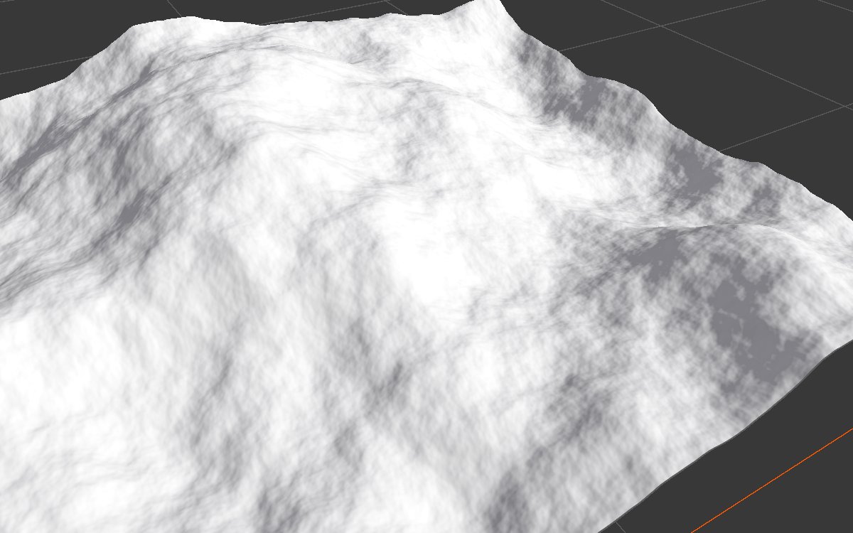 |
|
| Before (node bypassed) | Default settings |
The fine, sharp detail of the noise has weathered away on the steeper slopes, and smooth fans of debris have built up below them. The large shape is unchanged: this node relaxes the surface, it does not reshape mountains.
Settings compared
| Talus Angle 35 | Talus Angle 0, Erosion Rate 3 |
|---|---|
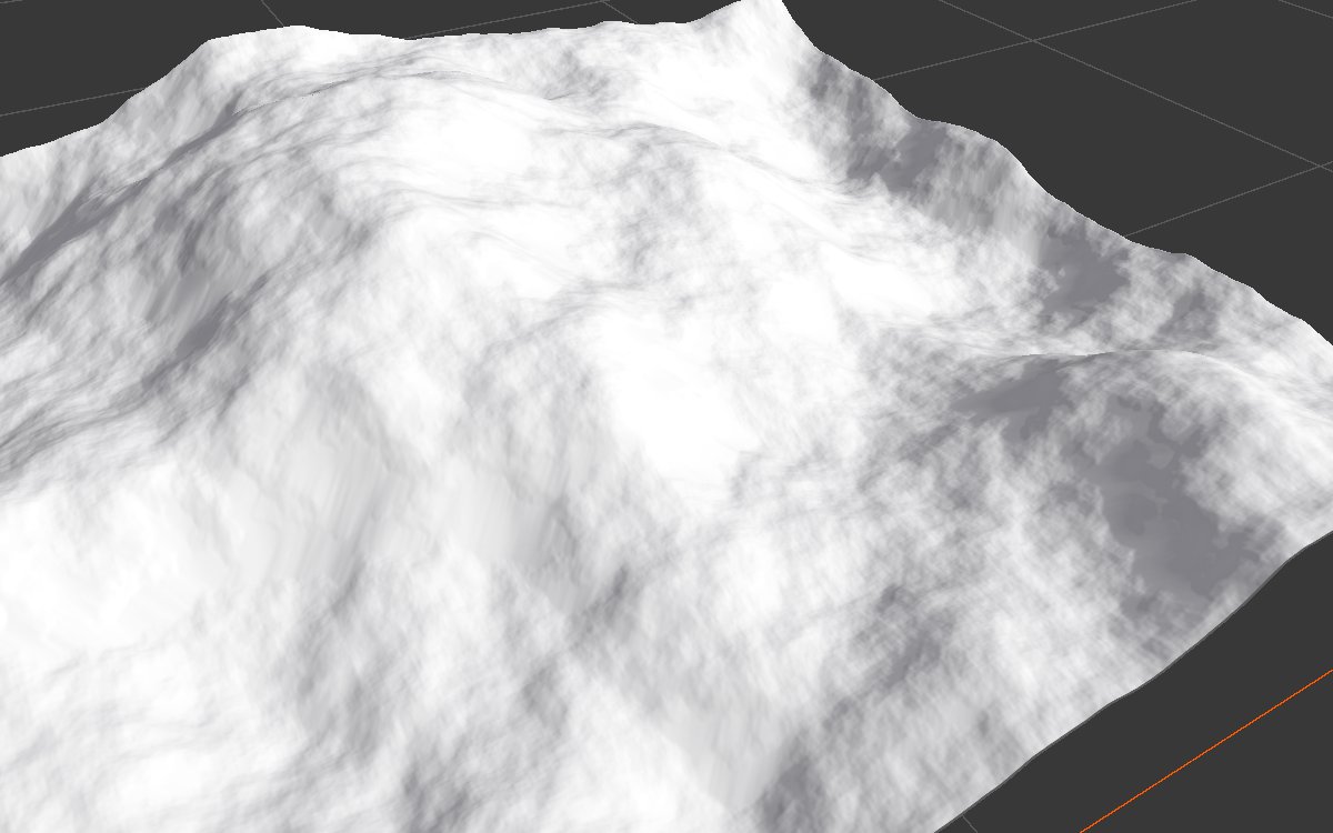 |
 |
| Few slopes here are steeper than 35 degrees, so almost nothing changes. | Every slope sheds material, three times as fast: the surface softens everywhere. |
| Iteration 3000 | Erosion Over Time constant at 1 |
 |
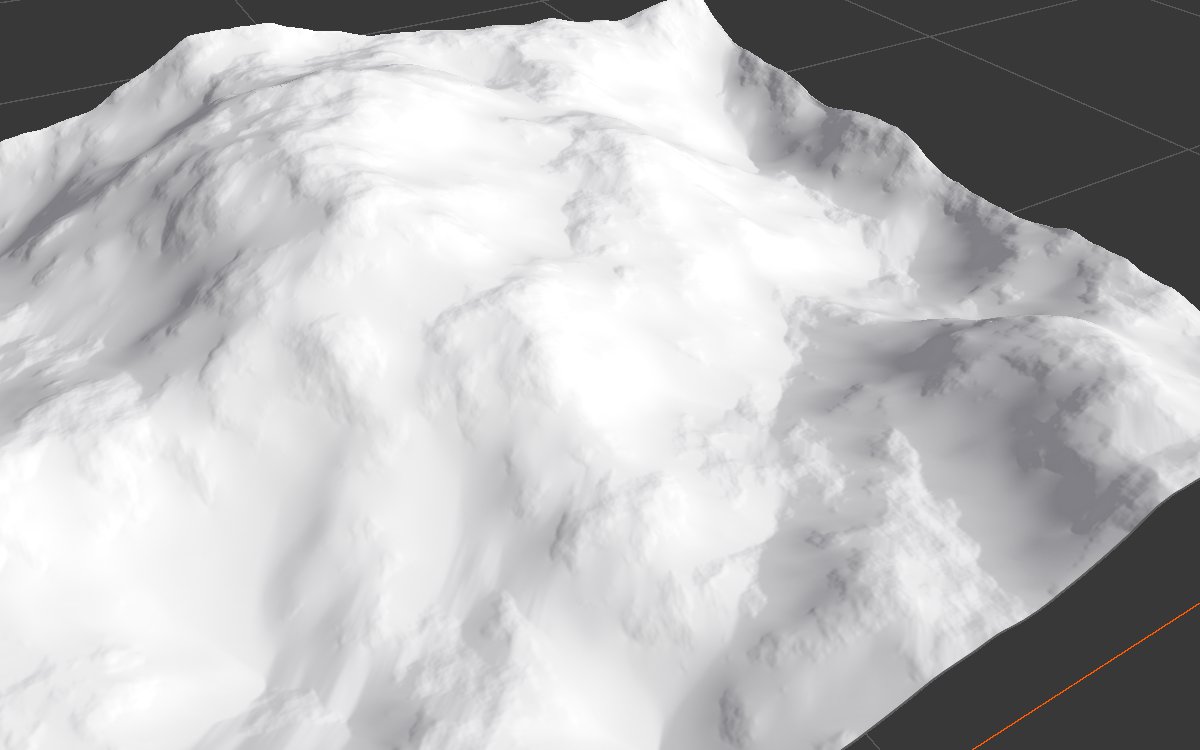 |
| Three times the run: older erosion, smoother slopes and wide debris aprons. | Material keeps breaking off until the end. Looks close to the default, with slightly rougher debris. |
Sediment and Exposure
| Sediment | Sediment, Talus Angle 35 | Exposure | Exposure, Talus Angle 35 |
|---|---|---|---|
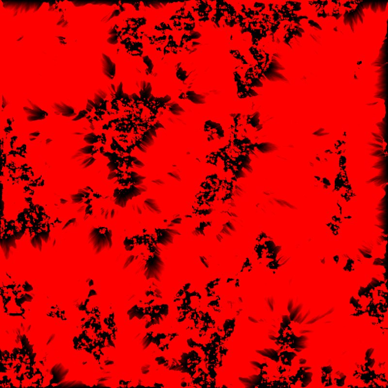 |
 |
 |
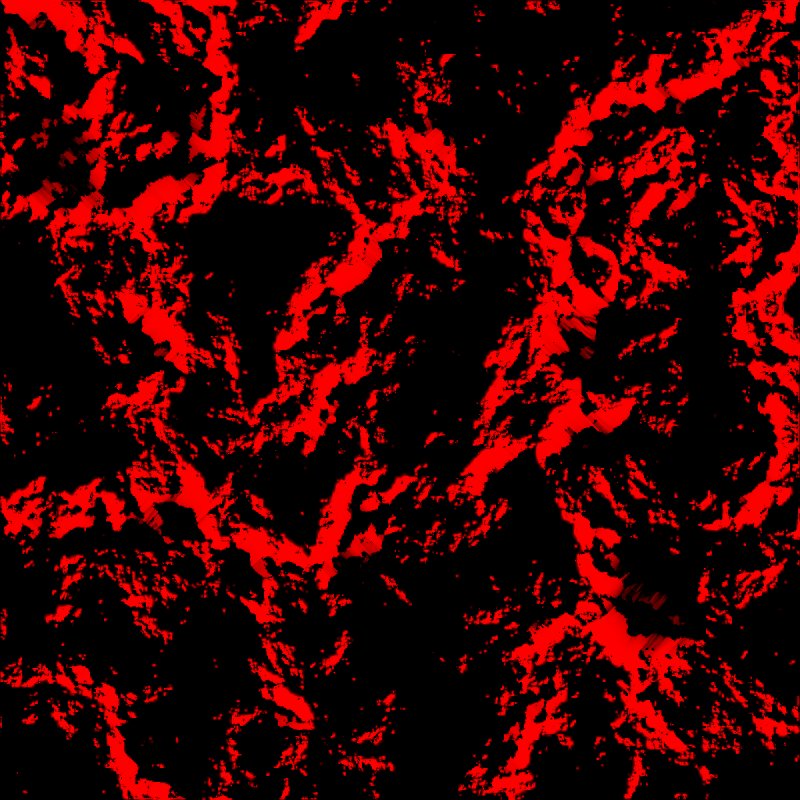 |
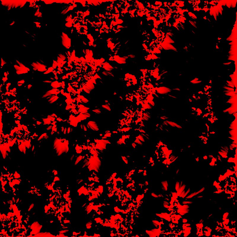
At the default Talus Angle of 15, loose material reaches most of this steep terrain, so Sediment covers about three quarters of it. At 35 degrees, it only settles below the steepest faces. Exposure marks the bare rock on the faces in both cases, which makes it the better mask for a rock texture.
Recipes
- Settled slopes after hydraulic erosion: Hydraulic Erosion 2 → Thermal Erosion 3 (Talus Angle 27, Erosion Rate 2, 500 iterations, Erosion Over Time full until about half way then fading to 0 by three quarters). Material runs through the channels and settles at the foot, while cliff walls stay steep. From the Mesa template.
- Sand dunes: dune shape → Thermal Erosion 3 (Talus Angle about 7.5, Erosion Rate about 5, Erosion Over Time constant at 1, about 500 iterations). Recipe
dunes-geometry. - Strong melting, for alien or worn land: three passes at Talus Angle 0 and Erosion Rate 3, with Resolution Relative To Graph at 0.25 (500 iterations), 0.5 (300) and 1 (150). It lowers the shape a lot, so start taller. Recipe
mars-surface. - Rock texture: Exposure → Set Variable → weight of a rock layer.
Warning
Raising Iteration or Erosion Rate a lot to soften big cliffs wipes out all the fine detail and looks fake. Relax cliffs in the shape instead (a larger noise scale or a lower height).
Note
How much it reshapes depends on the relief: on low terrain such as dunes it reshapes the whole form; on tall mountains it only relaxes the surface.
Performance
Moderate: cost grows with Iteration and resolution. Use Multi Resolution makes it much faster; keep it on. Like other simulations, it runs over several frames, and unchanged nodes load from the cache.
Related nodes
- Hydraulic Erosion 2: water erosion that carves gullies; the usual partner.
- Landslide, Slide: mass movement down slopes.
- Thermal Erosion, Thermal Erosion 2: older versions, deprecated.
For AI agents
- Type name:
ThermalErosionNode3. Inputs: Height =0, Hardness =1. Outputs: Height =100, Sediment =101, Exposure =102. - Properties:
iterationCount,useAutoIterationPerFrame,iterationPerFrame,useMultiResolution,useBorderFade,erosionRate(≥ 0),talusAngle(0 to 89),erosionOverTime(curve). - Runs over several frames: capture again until the stats stop changing.
- Measured on the sample terrain at defaults: Sediment covers about 74% fully, Exposure about 12%. The height mean barely changes (0.352): material is moved, not removed.