HSL Selector Node
- Category: Masking
- Edition: Vista Pro
- Output type: Mask
- Typical place in a graph: after a color image, usually satellite imagery from Load Real World Data, to turn its colors into masks for texturing and spawning
HSL Selector turns a color image into a mask by color. Give it satellite imagery or any color map, set a range of hue, saturation and lightness, and every spot whose color falls in all three ranges is selected. The defaults pick green, so out of the box it marks vegetation; other ranges pick bare earth, rock, sand, water or snow. Use it to place forests where the photo shows forest, rock textures where it shows rock, and so on.
When to use it
- Recreate a real place: forests, fields, rock and snow where the satellite imagery shows them.
- Pull masks out of a hand made or generated color map.
- Not for: masks from the terrain's shape, such as height or slope (use Height Mask, Slope Mask, Geometry Mask); picking a range of values in a mask (use Range Select).
Inputs
| Slot | Type | Required | What to connect |
|---|---|---|---|
| Input | Color | Yes | The color image to select from: satellite imagery from Load Real World Data, a Load Texture RGBA output, or a color map from Gradient Map or Color Blend. With nothing connected, the input is black and nothing is selected. |
Outputs
| Slot | Type | What it holds |
|---|---|---|
| Output | Mask | 1 where the color is inside all three ranges, 0 everywhere else. There are no values in between, so the edges are hard. |
Properties
| Property | Default | Range | What it does |
|---|---|---|---|
| Hue | 0.225 to 0.45 | 0 to 1 | The range of color shades, shown as a color strip above the slider. 0 and 1 are both red, then the strip runs through orange (about 0.08), yellow (0.17), green (0.33), cyan (0.5), blue (0.67) and magenta (0.83). The default covers yellow green to blue green. |
| Saturation | 0.25 to 1 | 0 to 1 | How strong the color is, from grey (0) to vivid (1). Raising the minimum leaves out washed out, greyish areas. |
| Lightness | 0.25 to 1 | 0 to 1 | How bright the color is, from black (0) to white (1). Raising the minimum leaves out shadows and dark areas. |
A spot is selected only when its color is inside all three ranges.
Picking a color
Under the sliders there are two quicker ways to set the ranges from a color:
- Pick from 2D Viewport: turn it on, then click or drag in the 2D view. It reads the color drawn on screen under the cursor.
- The color field next to it: pick a color with Unity's color picker or its eyedropper.
Both set Hue to a narrow band around the picked color (about 0.025 either side, roughly 9 degrees) and reset Saturation and Lightness to the full 0 to 1, so only the shade counts. Narrow the other two afterwards if needed.
Common properties
| Property | What it does |
|---|---|
| Id | The node's unique name in this graph, shown for reference. You cannot edit it. Scripts and the AI workflow CLI use it to find the node. |
| Resolution | How detailed this node's result is, in texels across the biome. Relative To Main Input (default) matches the image connected to Input, times the multiplier below it. Relative To Graph follows the biome's Canvas Resolution instead. Absolute sets an exact size. Absolute is limited to 32 to 512 in Vista Personal and 32 to 4096 in Vista Indie and Pro. |
| Split Execution | Lets this node run over several frames so the editor stays responsive during long generations. It only works when Allow Split Execution is on in the graph settings. This node finishes in one step, so splitting only adds a short pause around it; leave it off. |
| Bypass | Skips the node. Its input is a color image, not a mask, so nothing comes out, and the nodes after it act as if nothing were connected. |
Examples
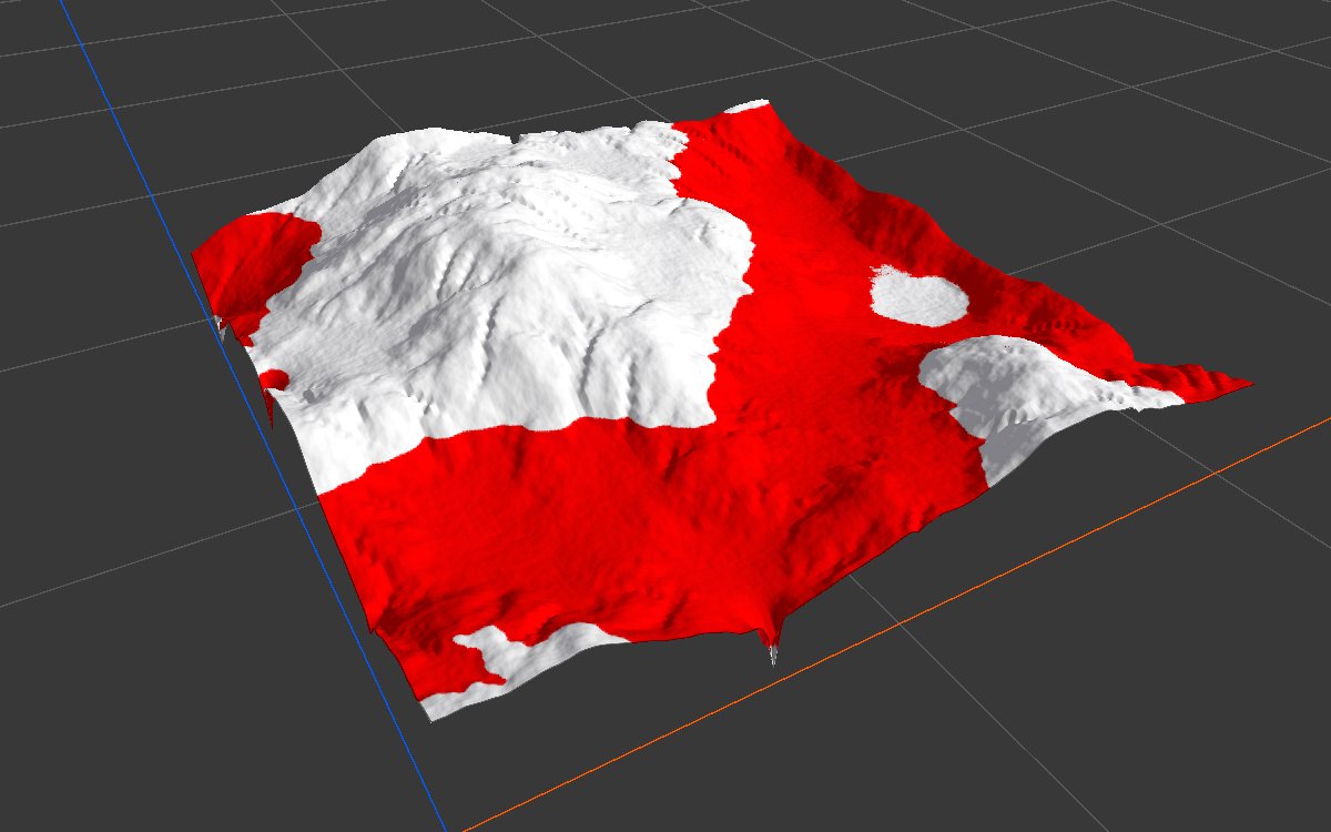
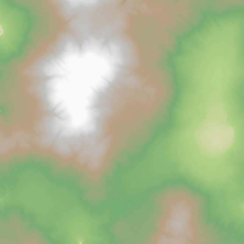
These examples use a stand in for satellite imagery: a color map made from the height of eroded mountains with Gradient Map, running from green lowlands through brown and grey slopes to white peaks. Real imagery is noisier, but the settings work the same way. The biome is 1024 × 1024 m with a terrain height of 400 m. The 2D view shows the mask from black to red; the 3D view shows it in red over the terrain.
| Setting | 2D | 3D |
|---|---|---|
| Default (vegetation): Hue 0.225 to 0.45, Saturation 0.25 to 1, Lightness 0.25 to 1 | 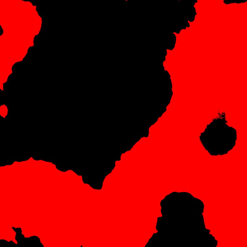 |
|
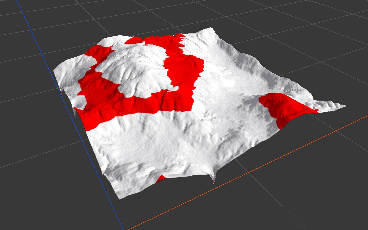
| Bare earth: Hue 0 to 0.15, Saturation 0.1 to 1, Lightness 0 to 0.85 | 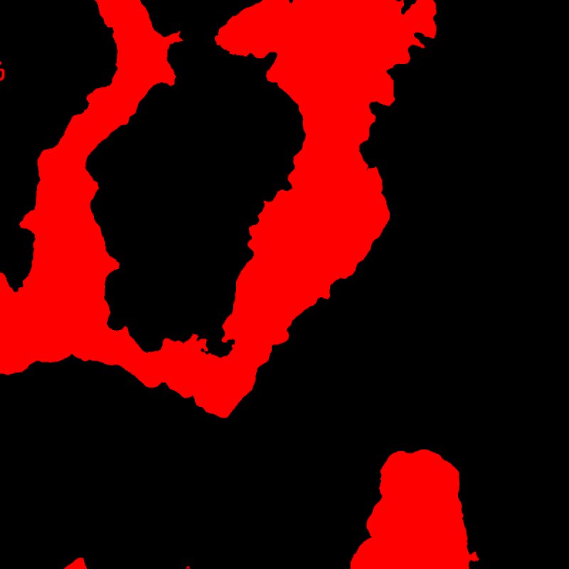 |
 |
| Snow: Hue 0 to 1, Saturation 0 to 1, Lightness 0.6 to 1 | 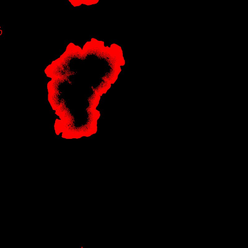 |
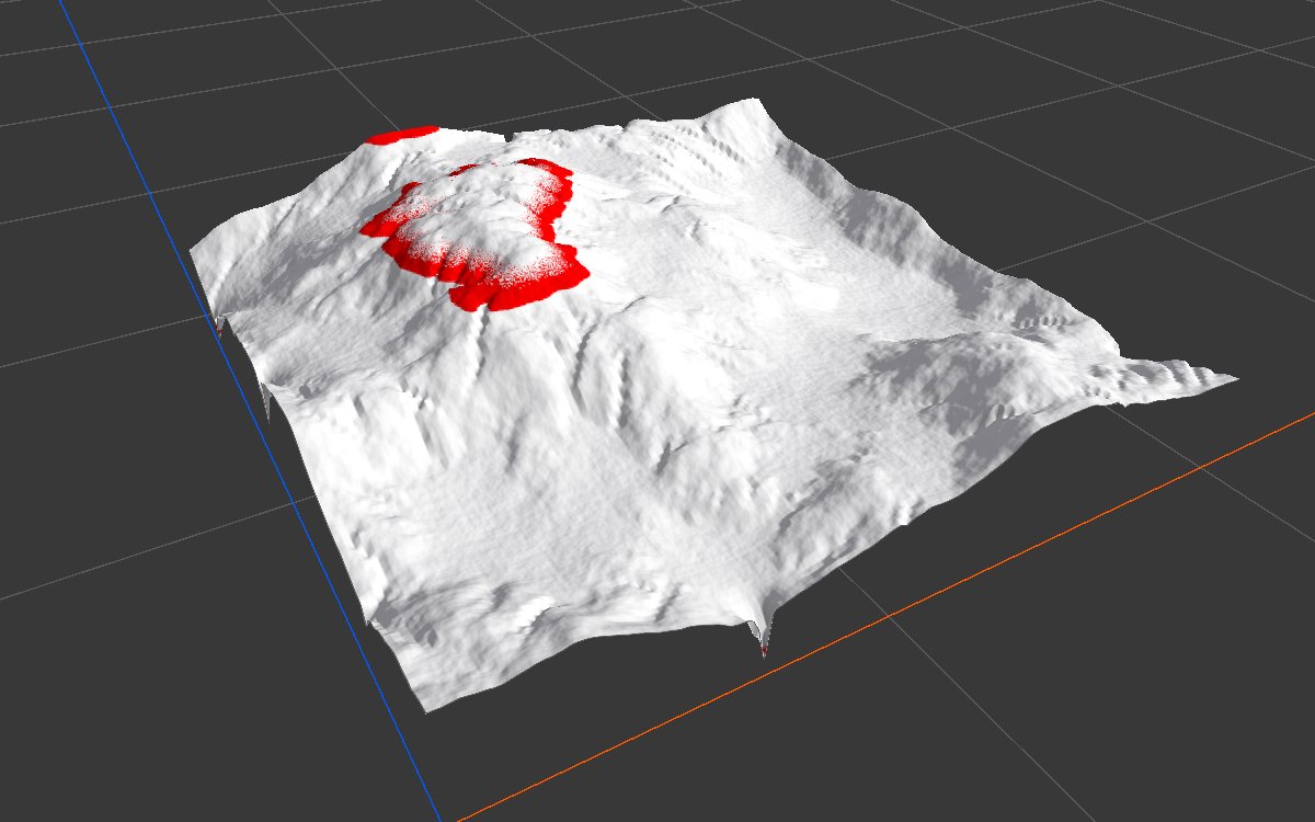 |
The default range selects the green half of the map (52%). The bare earth range picks the brown band on the slopes (25%). The snow range should select the whole top of the highest mountain, but its summit is missing: the summit is pure white, and pure greys are never selected (see the warning below).
Recipes
- Forest from satellite imagery: Load Real World Data imagery → HSL Selector (green, Lightness limited to the darker greens) → Blur → Scatter density → Tree Output.
- Several land covers: one HSL Selector per cover (forest, grass, earth, rock) from the same imagery, each to its own texture layer.
- Red shades: red sits at both ends of the hue strip. Use two HSL Selectors, one near 0 and one near 1, and join them with Combine (Max).
Warning
Pure grey, white and black, where red, green and blue are exactly equal, are never selected, whatever the ranges. In satellite imagery this hits snow, clouds and glare that are clipped to pure white. In the test below, tinting the white very slightly fills the hole and doubles the selected area, from 4% to 9%. If you need those areas, take them from a lightness or height based mask instead.
| Pure white peak | Peak tinted very slightly |
|---|---|
|
 |
Tip
The mask has hard edges and follows every speck of noise in real imagery. Clean it with Blur, then Threshold or Levels, before using it.
Note
The 2D view can show a color image lighter than the values HSL Selector reads, so a range that looks right by eye may select less than expected. Check the result in the 2D view and adjust; Lightness usually needs to be lower than it looks.
Note
Hue does not wrap around: a range from 0.9 to 0.1 is not possible. Use two nodes for red, as in the recipe above.
Performance
Very cheap: one quick GPU step.
Related nodes
- Load Real World Data: downloads satellite imagery and elevation.
- Range Select: the same kind of hard selection on a mask's values.
- Gradient Map: turns a mask into a color map.
For AI agents
- Type name:
HSLSelectorNode(Vista Pro, Real World Data module). Slot ids: Input =0(ColorTexture), Output =100(Mask). - Properties for
vista_graphitor_node_set:minHue,maxHue,minSaturation,maxSaturation,minLightness,maxLightness(each clamped to 0 to 1; min is not forced below max). - Output = 1 if H, S and L are each within [min, max] (inclusive), else 0. Hue in 0 to 1, no wrap.
- Exactly grey pixels (R = G = B) give an undefined hue in the shader and are never selected; measured: pure white summit 4.2% coverage, same summit tinted #F2F2EE 8.6%.
- Picking (editor only): hue ±0.025 around the picked color, saturation and lightness reset to 0 to 1.
- Measured on the Gradient Map stand in: default 51.5%; hue 0 to 0.15, sat 0.1 to 1, light 0 to 0.85 gives 25.1%.
- Bypass gives no output.