Height Mask Node
- Category: Masking
- Edition: All editions
- Output type: Mask
- Typical place in a graph: after the final height, feeding texture layers and spawn rules
Height Mask selects ground by altitude. Give it the terrain height and a range in meters, and it marks everything between them, shaped by a Transition curve. Use it for anything that changes with altitude: beaches and lowland near the water, grass and forest up to a tree line, rock and snow on the high ground.

When to use it
- Texture by altitude: sand at the bottom, grass in the middle, rock and snow on top.
- A tree line: forest only up to a certain height, fading out.
- Limit any effect to a height band, such as wet ground near water.
- Not for: selecting by steepness (use Slope Mask), or several rules at once (use Geometry Mask); a band of values in a mask that is not a height (use Range Select).
Inputs
| Slot | Type | Required | What to connect |
|---|---|---|---|
| Height | Mask | Yes | The terrain height, usually the final height after erosion. |
Outputs
| Slot | Type | What it holds |
|---|---|---|
| Output | Mask | The Transition curve's value across the range. Below Min Height it holds the curve's left end, above Max Height its right end. |
Properties
| Property | Default | Range | What it does |
|---|---|---|---|
| Min Height | 0 | 0 and up, meters | Bottom of the range, in meters above the terrain floor. It cannot go above Max Height. |
| Max Height | 100 | 0 and up, meters | Top of the range. It cannot go below Min Height. |
| Transition | Fades in over the first tenth, full in the middle, fades out over the last tenth | Curve from 0 to 1 | Mask strength across the range, from Min Height (left) to Max Height (right). Shape it to fade in, fade out, or both. |
The heights are real meters, measured with the terrain height, so the same values select the same altitude whatever the biome.
Common properties
| Property | What it does |
|---|---|
| Id | The node's unique name in this graph, shown for reference. You cannot edit it. Scripts and the AI workflow CLI use it to find the node. |
| Resolution | How detailed this node's result is, in texels across the biome. Relative To Main Input (default) matches the height connected to Height, times the multiplier below it. Relative To Graph follows the biome's Canvas Resolution instead. Absolute sets an exact size. Absolute is limited to 32 to 512 in Vista Personal and 32 to 4096 in Vista Indie and Pro. |
| Split Execution | Lets this node run over several frames so the editor stays responsive during long generations. It only works when Allow Split Execution is on in the graph settings. This node finishes in one step, so splitting only adds a short pause around it; leave it off. |
| Bypass | Skips the node. Nothing comes out, and the nodes after it act as if nothing were connected. |
Examples
All examples measure the same eroded mountains (Noise, Scale 600, then Hydraulic Erosion 2) on a 1024 × 1024 m biome with a terrain height of 400 m; the land reaches from about 18 m to 256 m. The 2D view shows the mask from black to red; the 3D view shows it in red over the terrain.
| Setting | 2D | 3D |
|---|---|---|
| Default: 0 to 100 m | 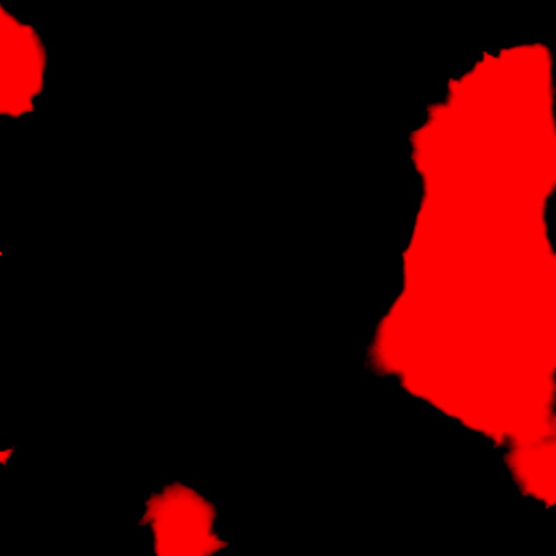 |
 |
| High ground: 150 to 400 m, rising quickly to full |  |
|
| Lowland: 0 to 120 m, full at the bottom and fading out |  |
 |
The default range marks the low ground with a short fade at both ends. For the high ground, the curve rises to full quickly and stays there, so everything above about 190 m is selected. For the lowland, the curve starts at full and fades out toward 120 m, which gives a soft upper edge, the usual set up for beaches or a tree line.
Recipes
- Snow line: Height Mask (Min at the snow line, Max above the peaks, curve rising) × Slope Mask (gentle slopes) → snow layer. For a full winter, use Snow Fall 2.
- Beach: Height Mask (0 to about 25 m) × Slope Mask (0 to 20 degrees). Recipe
beach-shoreline. - Tree line: forest mask × Height Mask (curve full at the bottom, fading out at the tree line) → Scatter.
Tip
Fade the curve over a wide part of the range for natural transitions; a hard edge reads as an artificial line around the mountain.
Note
The range is in meters, so changing the Vista Manager's Max Height changes which ground is selected, since the land itself gets taller or lower.
Performance
Very cheap: one quick GPU step.
Related nodes
- Slope Mask, Direction Mask: select by steepness and facing direction.
- Geometry Mask: height, slope and direction in one node.
- Range Select: a hard band of values.
For AI agents
- Type name:
HeightMaskNode. Input Height0, Output100. - Properties:
minHeight,maxHeight(meters, min ≤ max),transition(curve; time 0 = minHeight, 1 = maxHeight). - Output = transition(saturate(inverseLerp(min, max, height in meters))). Below min the curve's value at 0; above max its value at 1.
- Bypass produces no output.