Slope Mask Node
- Category: Masking
- Edition: All editions
- Output type: Mask
- Typical place in a graph: after the final height (after erosion), feeding texture layers and spawn rules
Slope Mask selects ground by how steep it is. Give it the terrain height and an angle range, and it marks every place whose slope falls in that range: flat land for grass, roads or buildings, gentle slopes where trees can grow, steep faces and cliffs for rock. It is the most common way to put rock textures on cliffs and keep vegetation off them.

When to use it
- Put a rock or cliff texture on steep faces.
- Keep trees, grass and objects off slopes that are too steep for them.
- Find flat ground for grass, sand, snow, buildings or roads.
- Limit another effect to a slope range, such as erosion detail or snow, by multiplying it with this mask.
- Not for: selecting by altitude (use Height Mask), by the direction a slope faces, such as north faces for snow (use Direction Mask), or several of these at once (use Geometry Mask, which combines height, slope and direction in one node).
Inputs
| Slot | Type | Required | What to connect |
|---|---|---|---|
| Height | Mask | Yes | The terrain height to measure, usually the final height after erosion. With nothing connected, the ground counts as perfectly flat everywhere. |
Outputs
| Slot | Type | What it holds |
|---|---|---|
| Output | Mask | 1 where the slope is inside the angle range, shaped by Transition, and 0 everywhere else. The edges of the range are hard cuts unless the Transition curve fades them. |
Properties
| Property | Default | Range | What it does on the terrain |
|---|---|---|---|
| Min Angle | 0 | 0 to 90 degrees | The gentlest slope that is selected. 0 is flat ground. It cannot go above Max Angle. |
| Max Angle | 45 | 0 to 90 degrees | The steepest slope that is selected. 90 is a vertical wall. It cannot go below Min Angle. |
| Transition | Fades in over the first tenth of the range, full in the middle, fades out over the last tenth | Curve from 0 to 1 | The mask strength across the range: the left end of the curve is Min Angle, the right end is Max Angle. Use it to soften the edges of the selection so textures blend instead of cutting off. Keep the curve at 1 on an end you want fully selected. |
The angles are real slope angles of the terrain in the scene, in degrees. They are measured with the biome's actual size and the terrain height, so 30 degrees means the same steepness on any biome.
Common properties
| Property | What it does |
|---|---|
| Id | The node's unique name in this graph, shown for reference. You cannot edit it. Scripts and the AI workflow CLI use it to find the node. |
| Resolution | How detailed this node's result is, in texels across the biome. Relative To Main Input (default) matches the height connected to Height, times the multiplier below it. Relative To Graph follows the biome's Canvas Resolution instead. Absolute sets an exact size. Matching the height's resolution keeps the mask aligned with the terrain detail; a lower resolution gives a softer, blockier selection. Absolute is limited to 32 to 512 in Vista Personal and 32 to 4096 in Vista Indie and Pro. |
| Split Execution | Lets this node run over several frames so the editor stays responsive during long generations. It only works when Allow Split Execution is on in the graph settings. This node finishes in one step, so splitting only adds a short pause around it; leave it off. |
| Bypass | Skips the node. Slope Mask does not pass the height through: nothing comes out, and the nodes after it act as if nothing were connected. |
Examples
All examples measure the same terrain: a Noise with a mesa Remap curve, so it has flat plateau tops, tall cliffs, gentle slopes and flat lowland, on a 1024 × 1024 m biome with a terrain height of 400 m. The 2D view shows the mask from black (0) to red (1). The 3D view shows the mask in red over the terrain.
Default settings: 0 to 45 degrees
| Property | Value |
|---|---|
| Min Angle | 0 |
| Max Angle | 45 |
| Transition | Default (fades at both ends) |


Everything gentler than 45 degrees is selected and the cliffs are left out. Look at the plateau top: because the default curve fades out at Min Angle, the flattest parts drop out too, and the top is only patchily selected. See the warning below.
Cliffs: 30 to 90 degrees
| Property | Value |
|---|---|
| Min Angle | 30 |
| Max Angle | 90 |
| Transition | Full from 0.05 to the end |

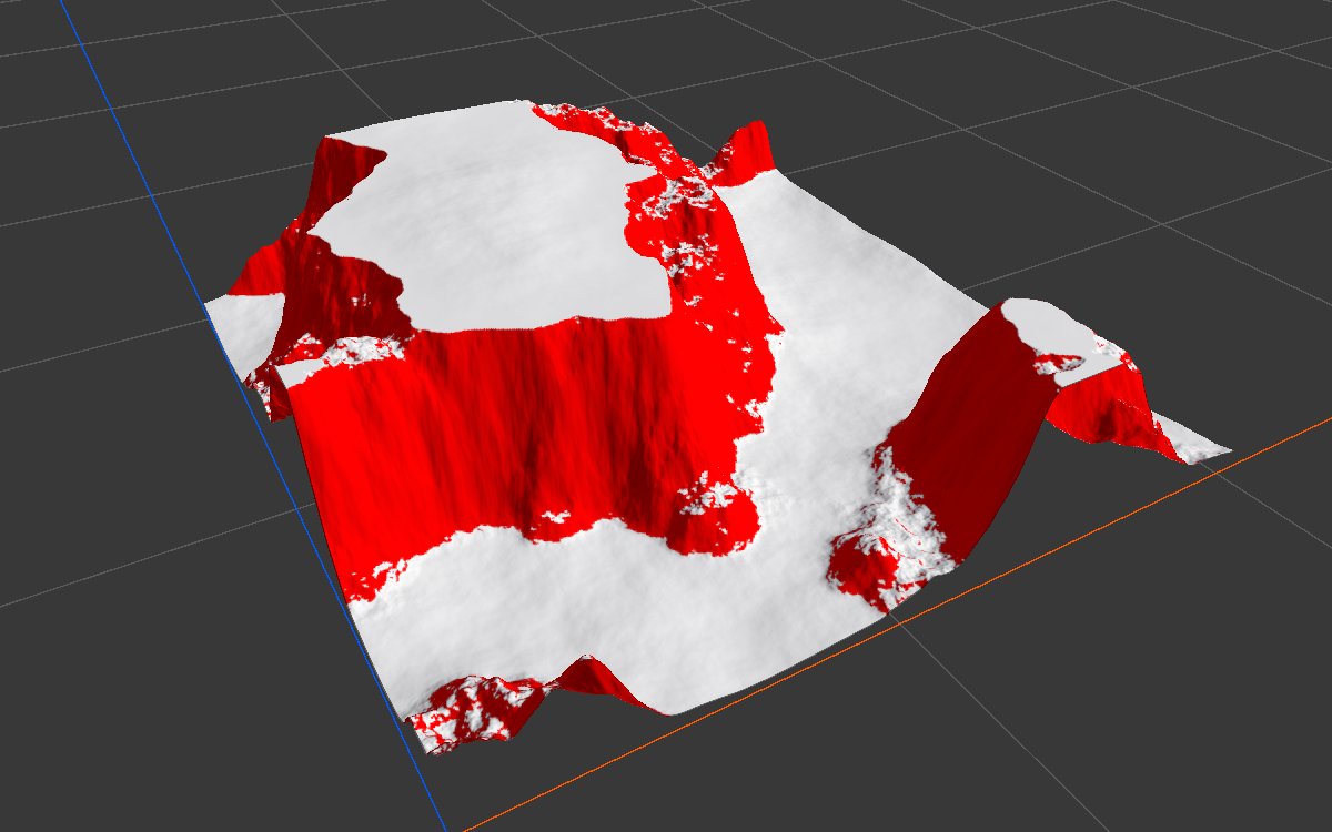
The classic rock mask. The curve rises to full almost at once and stays there up to 90 degrees, so every face steeper than about 30 degrees is selected at full strength, including vertical walls. Use it as the weight of a rock texture layer. Lower Min Angle to 25 for more rock, raise it to 40 to keep rock only on the sheerest faces.
Flat ground: 0 to 5 degrees
| Property | Value |
|---|---|
| Min Angle | 0 |
| Max Angle | 5 |
| Transition | Flat at 1 |


With a curve that stays at 1, flat ground is selected at full strength, which the default curve would have faded out. Good for grass, sand or snow on level ground, or to find room for buildings and roads.
Gentle slopes: 0 to 25 degrees, fading out
| Property | Value |
|---|---|
| Min Angle | 0 |
| Max Angle | 25 |
| Transition | Full from 0 to 0.7, fading to 0 at 1 |
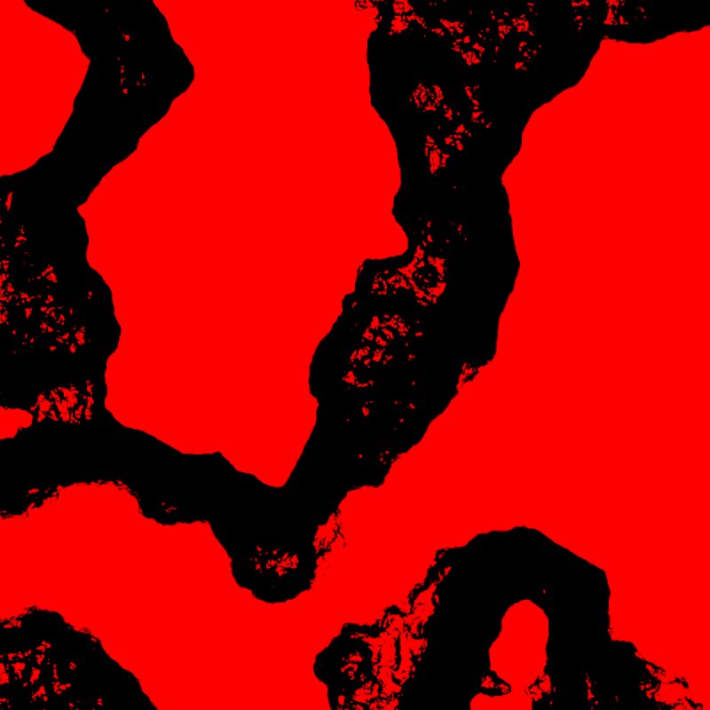
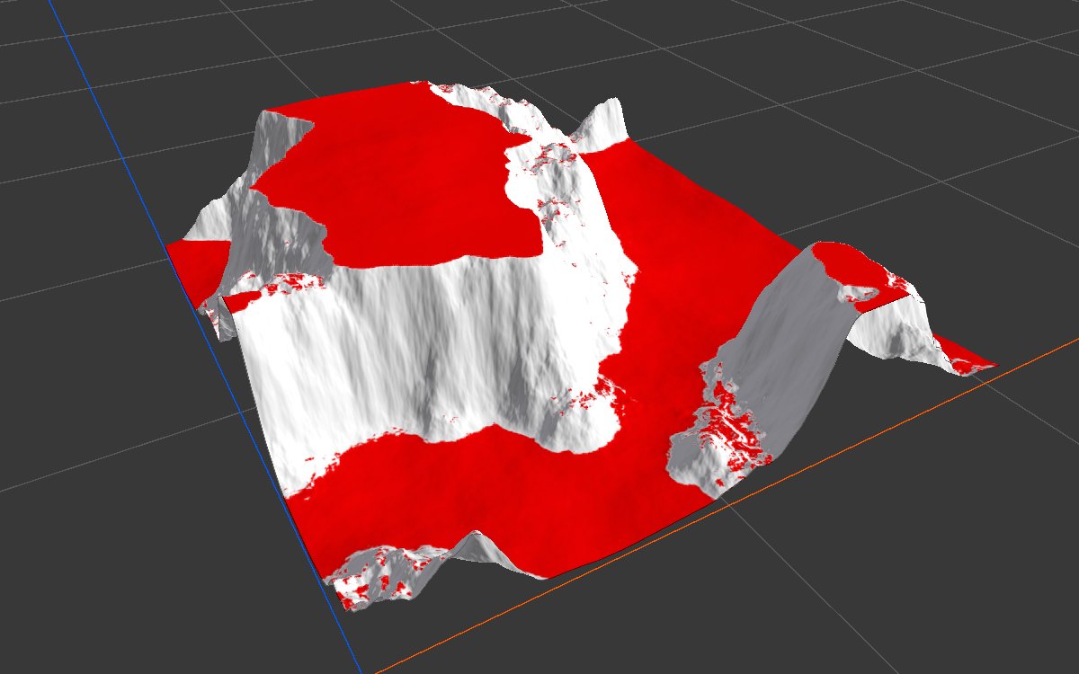
Full strength from flat up to about 17 degrees, then a fade to nothing at 25. This is a typical rule for where trees and grass can grow: they thin out as the ground gets steeper instead of stopping at a hard line.
Soft cliff edges: 20 to 90 degrees
| Property | Value |
|---|---|
| Min Angle | 20 |
| Max Angle | 90 |
| Transition | Rising from 0 to full at 0.45, then full |
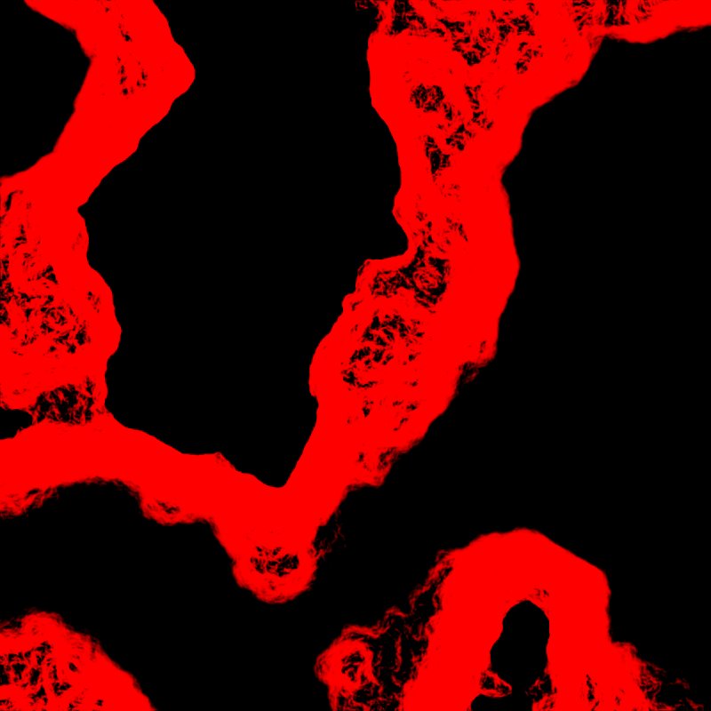

Compared with the cliff example, the curve now rises slowly, from nothing at 20 degrees to full at about 50 degrees. On a rock texture this gives a soft blend from soil to rock instead of a hard edge.
Recipes
- Rock on cliffs: final height → Slope Mask (30 to 90, sharp rise) → weight of the rock layer in Weight Blend, or directly into a Texture Output.
- Trees only where they can stand: your forest mask × Slope Mask (0 to 25 or 30, fading out at the end) in Combine (Multiply) → Scatter → Tree Output. The AI workflow recipe
trees-on-green-areadoes this with Geometry Mask, which adds a height limit in the same node. - Beach: Slope Mask (0 to 20) × Height Mask (0 to about 25 m) for a low, flat band above the water. Recipe
beach-shoreline. - Flat ground at full strength: Slope Mask (0 to 3, curve flat at 1). Used in recipe
peak-highlight-from-erosionto tell flat ground apart from peaks.
Tip
Measure the slope on the final height, after erosion. Erosion flattens valleys and steepens gullies, so a mask read from the raw shape puts rock where the ground has since become flat.
Tip
To blend two textures by slope without a gap, use one Slope Mask for the rock and the same mask flipped for the soil (Math with One Minus, or a second Slope Mask with the opposite range), or let Weight Blend normalize the layers.
Note
The angles are measured on the real terrain size. If you change the terrain height in the Vista Manager or the biome size, the same graph selects different ground, because the slopes themselves change.
Warning
With the default Transition curve and Min Angle 0, perfectly flat ground is not selected: the curve starts at 0. If you want flat ground included, raise the left end of the curve to 1.
Warning
Min Angle cannot go above Max Angle and the other way around. When you raise both, raise Max Angle first, or Min Angle stops at the old maximum.
Performance
Very cheap: one step on the GPU, reading each texel and its neighbors. Cost follows Resolution.
Related nodes
- Geometry Mask: height, slope and direction rules in one node.
- Height Mask: select by altitude.
- Direction Mask: select by the direction a slope faces.
- Curvature, Concave, Convex: select ridges, hollows and bumps instead of steepness.
- Weight Blend: blend texture layers using masks like this one.
For AI agents
- Type name:
SlopeMaskNode. - Slot ids: Height =
0(input, Mask), Output =100(Mask). - Properties for
vista_graphitor_node_set:minAngleandmaxAngle(degrees, 0 to 90, clamped so min ≤ max: setmaxAnglefirst when raising both),transition({"keys": [[time, value, inTangent, outTangent], ...]}, time 0 = minAngle, 1 = maxAngle). - Default transition keys: [[0,0],[0.1,1],[0.9,1],[1,0]], so slopes at exactly minAngle and maxAngle score 0.
- Outside the range the output is exactly 0. Bypass produces no output.
- Measured on the sample mesa terrain: 0 to 45 selects about 45% at full strength; 30 to 90 about 33%; 0 to 5 about 35%.
- Pitfalls: reading the raw shape instead of the eroded height; default curve dropping flat ground; min/max clamping order.