Load Real World Data Node
- Category: Data
- Edition: Vista Pro
- Output type: Height and color map
- Typical place in a graph: at the start of a graph that recreates a real place
Load Real World Data brings real elevation and satellite imagery into the graph. It reads a Data Provider asset, where you have selected a region on the map and downloaded its data, and outputs the region's height and color, stretched over the biome. Use it to build terrain from a real place, then erode, texture and populate it like any other height.
When to use it
- Recreate a real mountain, valley or coastline.
- Texture and populate from satellite imagery, with HSL Selector picking forest, grass and rock by color.
- Not for: images you made yourself (use Load Texture).
Outputs
| Slot | Type | What it holds |
|---|---|---|
| Height Map | Mask | The elevation, as a fraction of the provider's full height range (0 is its lowest possible height, 1 its highest). Empty if the asset has no height data. |
| Color Map | Color | The satellite or aerial imagery of the region. Empty if the asset has no imagery. |
Properties
| Property | Default | Range | What it does |
|---|---|---|---|
| Data Provider Asset | None | A Data Provider asset | The asset holding the downloaded region. Create one with Assets > Create > Vista > Data Provider (USGS), (Open Topography) or (Custom Tile Based), pick a region in its map view and download. See Data Provider assets. Without an asset, nothing comes out. |
Below the field, the node shows the asset's Source Min Height and Source Max Height: the real heights, in meters, that 0 and 1 stand for.
Common properties
| Property | What it does |
|---|---|
| Id | The node's unique name in this graph, shown for reference. You cannot edit it. Scripts and the AI workflow CLI use it to find the node. |
| Resolution | How detailed this node's result is, in texels across the biome. The node has no input, so Relative To Main Input (default) and Relative To Graph both follow the biome's Canvas Resolution, times the multiplier below. Absolute sets an exact size. The data is resampled to that size. Absolute is limited to 32 to 512 in Vista Personal and 32 to 4096 in Vista Indie and Pro. |
| Split Execution | Lets this node run over several frames so the editor stays responsive during long generations. It only works when Allow Split Execution is on in the graph settings. This node finishes in one step, so splitting only adds a short pause around it; leave it off. |
| Bypass | Skips the node. Nothing comes out. |
Examples
All examples use the Colorado sample data from the Vista Pro samples (Data_USGS_Colorado), on a 1024 × 1024 m biome with the Vista Manager's Max Height at 400 m.
| Height Map, as loaded | Color Map |
|---|---|
 |
 |
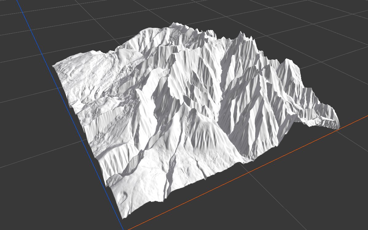
| Height as loaded, in 3D | Height through Remap (0 to 0.8) |
|---|---|
 |
|
| The values run from 0.615 to 1: this is high ground in USGS's range of -58 to 3922 m, so the land sits as a block near the terrain's top, with little relief. | Stretching the values to 0 to 0.8 brings out the shape, ignoring the real proportions. |
Recipes
- Real heights in meters: Load Real World Data Height Map → Real World Height Remap (drop the same Data Provider asset on it) → Height Output. See Height data remapping.
- Shape only: Height Map → Remap or Levels to the range you like.
- Forest from imagery: Color Map → HSL Selector (greens) → Scatter → Tree Output.
Note
The height comes as a fraction of the provider's range, not as meters. Without remapping, real land usually looks flat or raised. Remap it with Real World Height Remap for true proportions, or with Remap or Levels for the shape only.
Note
The downloaded region is stretched over the biome, whatever its real size. Match the biome's size and proportions to the region for a true scale.
Tip
Different providers can serve different maps for the same region, such as heights from one and imagery from another. Use one Load Real World Data node per asset.
Performance
Very cheap: one copy per output in use. Downloading happens in the Data Provider asset, not in the graph.
Related nodes
- Real World Height Remap: converts the height to real meters.
- HSL Selector: masks from the imagery's colors.
- Load Texture: images you made yourself.
For AI agents
- Type name:
LoadRealWorldDataNode(Vista Pro, Real World Data module). Outputs: Height Map =100(Mask), Color Map =101(ColorTexture). No inputs. - Property:
dataProviderAsset(asset path of a DataProviderAsset: USGS, OpenTopography or Custom Tiled). Outputs are written only when the asset has the map. - Height values are 0 to 1 over the provider's source range (USGS -58.3733 to 3922.473 m, OpenTopography 0 to 10000 m). Measured on the Colorado sample: 0.615 to 1, mean 0.815.
- Sample asset:
Assets/PinwheelStudio/Vista/Pro/Real World Data/Samples/LocalBiomeWithWorldData/Data_USGS_Colorado.asset.