Height data remapping
Downloaded height data usually stored in the range of [0,1] relative to the available height range from the server.
Open Topography: from 0 to 10000 meters.
USGS: from -58.3733 to 3922.473 meters.
Once loaded into a graph using Load Real World Data or Graph Input node, height data will still be in the [0,1] range above, which will not reflect the actual height level in the real world. You need to add a Real World Height Remap node to convert them back to the correct meters value:
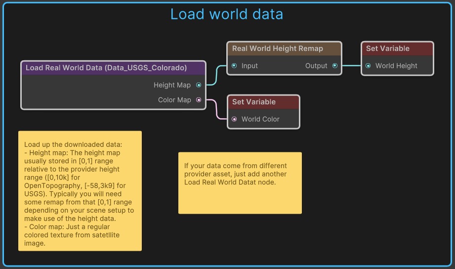
Figure: Vista for Unity height data remapping in the Unity Editor.
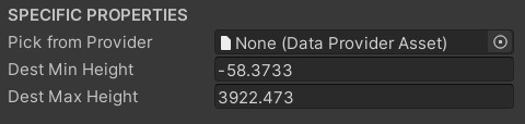
Figure: Vista for Unity height data remapping in the Unity Editor.
You can drop a data provider asset to the slot to retrieve the source height range from the service.
Under the hood, height data will be remapped from "[0,1] relative to source range" to "meters using Dest Min/Max Height", then from "meters" to "[0,1] relative to [0,graphHeight]"
| [0,1] relative to source range | -> | meters using Dest Min/Max Height | -> | [0,1] relative to [0,graphHeight] |
|---|
You also need to care about "ratio" when picking the "Dest" height range. For example:
If you're making a 1:1 model of the real world, then picking [-58,3922] for the Dest height range is OK.
In the Demo_LocalBiomeWithWorldData, we created a 1:10 model of the real world, so [0,400] will be a good value for the Dest height range. To be exact, it should be [-5.83,392.25]
Important: Your terrain's max height (configured via the Vista Manager) should be high enough to cover the data, otherwise it will be clipped.
Tip: If you are only interested in the terrain shape but not its correct proportion in the real world, just ignore this step and use a Levels node to adjust the height map as you like.