Snow Fall 2 Node
- Category: Nature
- Edition: All editions
- Output type: Height and four masks
- Typical place in a graph: last on the height, after erosion, before texturing
Snow Fall 2 simulates a winter on your terrain. Snow falls above a snow line and melts below it, sunny slopes hold less than shaded ones, wind strips exposed ridges and piles snow into sheltered slopes, and snow that a slope cannot hold slides down as avalanches. The Height output adds the snow on top of the ground, and four masks describe the result for texturing: where snow covers the ground, how deep it is, where avalanches ran, and where wind brought extra snow.

When to use it
- Snow capped mountains with a believable snow line, bare rock on steep faces and ridges, and deep snow in hollows.
- Texturing winter terrain: a snow layer from Coverage, powder versus crust from Depth, dirty chutes from Avalanche, wind slab from Drift.
- Soften the terrain under a thick blanket of snow (Height output).
- Not for: ice and glaciers that carve the land (combine with Hydraulic Erosion 2 and Thermal Erosion 3); a plain height based snow mask (use Height Mask × Slope Mask if you do not need wind and avalanches).
Inputs
| Slot | Type | Required | What to connect |
|---|---|---|---|
| Height | Mask | Yes | The ground the snow lands on, usually the final eroded height. It is only read; the Height output adds the snow on top. |
| Source | Mask | No | Where snow falls: white is the full Snowfall Rate. With nothing connected, it falls over the whole map. |
Outputs
| Slot | Type | What it holds |
|---|---|---|
| Height | Mask | The ground with the snow on it. |
| Coverage | Mask | Where snow hides the ground: almost black and white, for the snow terrain layer. Cover Depth sets how deep snow must be to read as white. |
| Depth | Mask | How thick the snow is, up to Depth Ramp, for blending between deep powder and thin crust. |
| Avalanche | Mask | The chutes where avalanches ran, on a log scale between Avalanche Min and Avalanche Max, for dirty or scoured snow. |
| Drift | Mask | Where wind brought more snow than it took away, up to Drift Ramp, for smooth wind loaded slopes and cornices. |
Properties
Apply Preset
The Apply Preset... button sets a tested starting point for everything except the snow line and the bearings, which depend on your terrain and scene.
| Preset | Look | Snowfall Rate / Iteration | Wind Strength | Bare Angle | Blanket |
|---|---|---|---|---|---|
| Light Dusting | A thin powdering, rock shows through | 1 / 200 | 1.5 | 52 | 0.3 |
| Winter Blanket | Deep, smooth cover on most slopes | 15 / 300 | 4 | 70 | 0.9 |
| Alpine (the defaults) | Snow capped peaks, bare steep rock, drifts | 10 / 400 | 12 | 62 | 0.75 |
| Himalayan | Very deep snow, strong wind, big avalanches | 30 / 600 | 40 | 64 | 0.85 |
| Wind Swept | Little snow, bare ridges, drifts in the lee | 6 / 400 | 30 | 60 | 0.6 |
General
| Property | Default | Range | What it does |
|---|---|---|---|
| Iteration | 400 | 1 and up | Length of the winter, in simulation steps. More steps let more snow fall and give wind and avalanches longer to move it. |
| Iteration Per Frame with Auto | Auto on | 1 and up | Steps per editor frame. Leave Auto on. |
| Feature Size | 8 | 4 and up, meters | Size of the smallest drift or chute. The simulation runs on a grid of this many meters per cell, then the result is fitted to the terrain at full resolution, so the masks stay sharp. Larger is faster with broader features. The grid stops at 1280 cells across; on a very large biome the node shows a warning and runs coarser. |
Snowfall
| Property | Default | Range | What it does |
|---|---|---|---|
| Snowfall Rate | 10 | 0 and up, millimeters per step | Snow added each step where Source is white. The total snowfall is about this times Iteration. |
| Snowfall Over Time | Full until 0.85, off at the end | Curve from 0 to 1 | Snowfall strength over the run, from start (left) to end (right). Fade it to 0 near the end so sliding snow can settle. |
| Variation | 0.35 | 0 to 1 | How unevenly snow falls and holds. Higher looks patchier; it also wobbles the snow line. |
| Snow Line | 0 | 0 and up, meters | Altitude above the terrain floor where snow falls at full rate. 0 means it falls at any height. Not part of the presets: set it for your terrain. |
| Line Softness | 150 | 0 and up, meters | How far below the Snow Line the snowfall fades out and melting fades in. |
| Melt Rate | 15 | 0 and up, millimeters per step | Snow melted each step below the snow line. Above Snowfall Rate, little snow survives below the line. |
| Sun Bearing | 180 | Degrees | Compass bearing toward the sun: 0 is +Z, 90 is +X. Match your scene's light. |
| Sun Influence | 100 | 0 and up, meters | How far a slope facing the sun raises the snow line, and a slope facing away lowers it. |
Wind
| Property | Default | Range | What it does |
|---|---|---|---|
| Wind Strength | 12 | 0 and up, millimeters per step | Snow lifted each step from fully exposed ground. Above Snowfall Rate, the most exposed ridges stay bare. 0 turns wind off. |
| Wind Direction | 90 | Degrees | Compass bearing the wind blows toward: 0 is +Z, 90 is +X. |
| Wind Variation | 25 | 0 to 180 degrees | How far gusts swing to either side. Higher softens drifts into fans. |
| Drift Distance | 120 | 1 and up, meters | Average distance blown snow travels before landing on open ground. Sheltered ground catches it much sooner. |
| Shelter Distance | 240 | 1 and up, meters | How far upwind terrain can still shelter a slope. Higher gives big ridges a longer lee side. |
| Windward Bias | 0.3 | 0 to 1 | How much more snow falls on slopes facing the wind than on slopes facing away. |
Avalanche
| Property | Default | Range | What it does |
|---|---|---|---|
| Repose Angle | 38 | 1 to 80 degrees | Slopes up to this angle hold snow at any depth. Steeper slopes shed what they cannot hold. |
| Bare Angle | 62 | 1 to 89 degrees | Above this slope, snow does not stick at all. Lower shows more rock faces. |
| Hold Depth | 200 | 0 and up, centimeters | Snow a slope holds just above the Repose Angle. It drops quickly as the slope steepens. |
| Runout Angle | 18 | 0 to 80 degrees | Below this slope, sliding snow stops quickly. Lower lets avalanches run out further across valley floors. |
| Momentum | 0.7 | 0 to 0.95 | How much momentum sliding snow keeps. Higher runs wider around bends and further out. |
| Channeling | 1.5 | 0 to 8 | How strongly sliding snow favors the steepest way down. 0 spreads into wide sheets; higher forms thin chutes. |
Output
| Property | Default | Range | What it does |
|---|---|---|---|
| Blanket | 0.75 | 0 to 1 | How much the snow has a smooth surface of its own, in the Height output. 0 follows every bump of the terrain; 1 fills hollows and lets rocks poke through where it is thin. |
| Cover Depth | 8 | 0.01 and up, centimeters | Snow depth that reads white in Coverage. Raise it to show more rock through thin snow. |
| Depth Ramp | 400 | centimeters | Snow depth that reads white in Depth. Keep it close to the snow that actually falls (Snowfall Rate × Iteration, in millimeters), or Depth stays dark. |
| Avalanche Min, Avalanche Max | 20, 400 | Flow | The range of avalanche flow mapped from black to white in Avalanche, on a log scale. Raise Avalanche Min to keep only the main chutes. |
| Drift Ramp | 100 | centimeters | Net snow brought by wind that reads white in Drift. |
Common properties
| Property | What it does |
|---|---|
| Id | The node's unique name in this graph, shown for reference. You cannot edit it. Scripts and the AI workflow CLI use it to find the node. |
| Resolution | The size of the outputs, in texels across the biome. Relative To Main Input (default) matches the height connected to Height, times the multiplier below it. The simulation itself runs at Feature Size; fine detail in the masks comes from this output resolution. Absolute is limited to 32 to 512 in Vista Personal and 32 to 4096 in Vista Indie and Pro. |
| Split Execution | This node always runs over several frames so the editor stays responsive; the viewports update as it bakes. Iteration Per Frame sets the pace. |
| Bypass | Skips the node. The input height passes through without snow, and the masks are empty. |
Examples
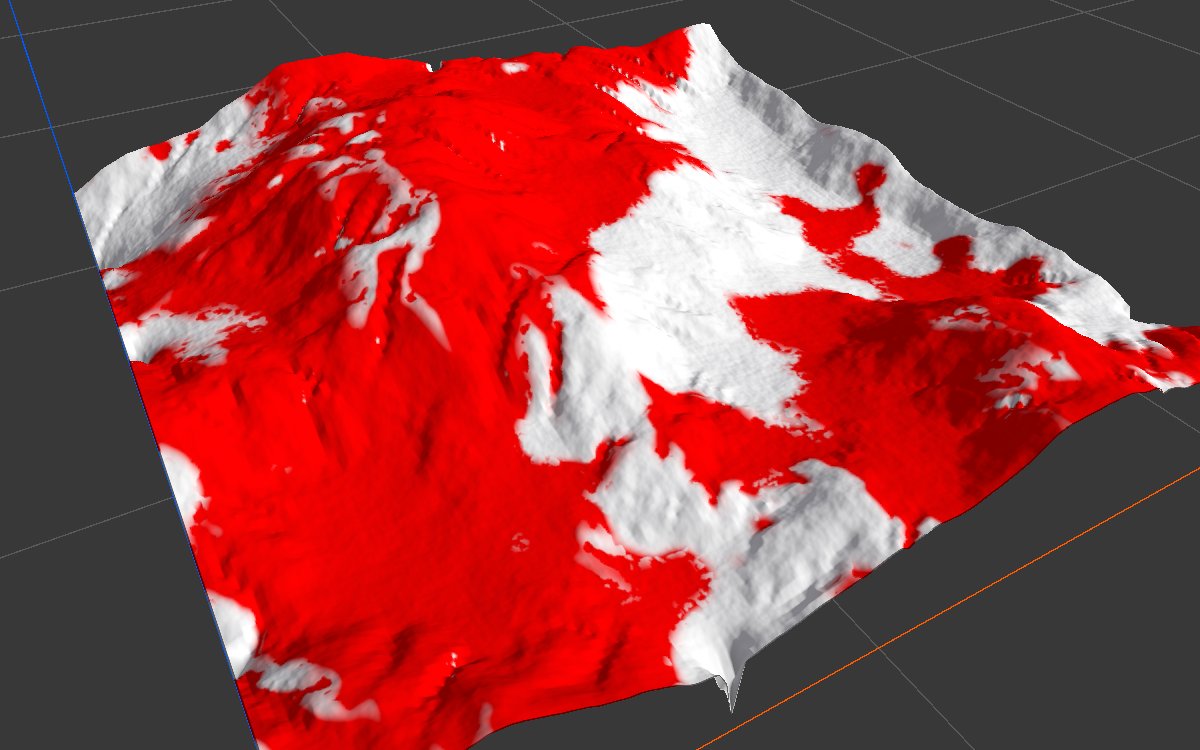
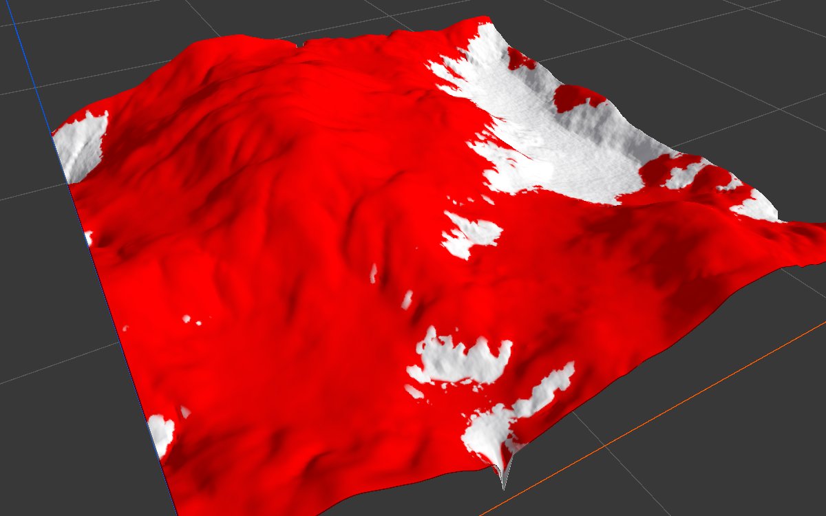
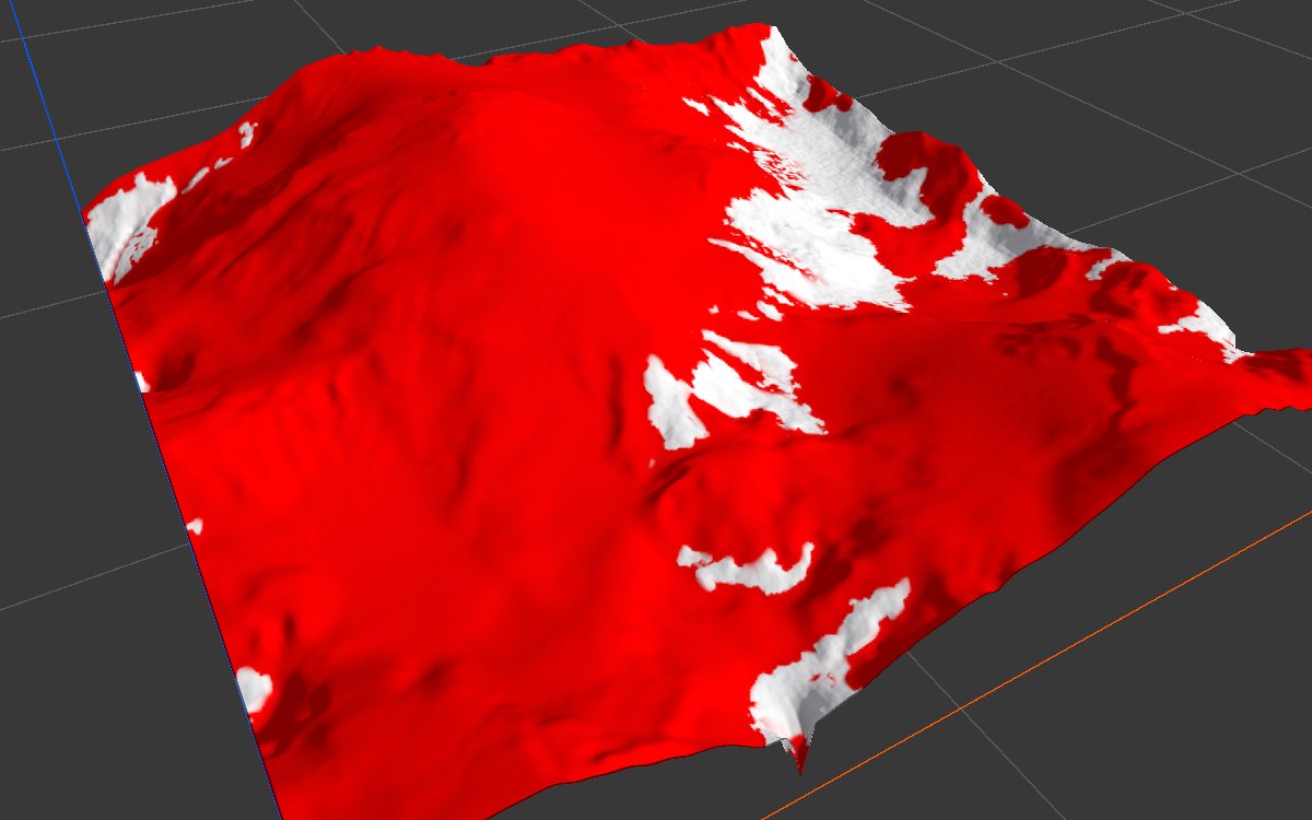
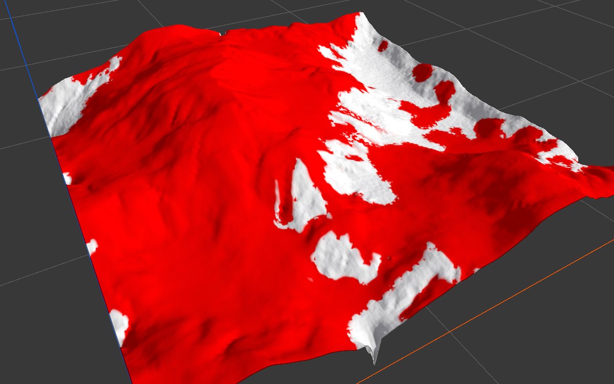
All examples snow on the same eroded mountains (Noise, Scale 600, Seed 128, then Hydraulic Erosion 2) on a 1024 × 1024 m biome with a terrain height of 400 m. The 2D view and the red overlay in 3D show Coverage. Each bake took about 20 seconds.
Snow line
| Snow Line 0 (Alpine defaults) | Snow Line 150 |
|---|---|
 |
 |
 |
|
With Snow Line at 0 snow falls everywhere, and only the steepest spots stay bare. At 150 m the lower valleys melt clear, with a ragged edge from Variation, Line Softness and the sun. The following examples all use a 150 m snow line.
Presets
| Light Dusting | Winter Blanket |
|---|---|
 |
 |
| Himalayan | Wind Swept |
 |
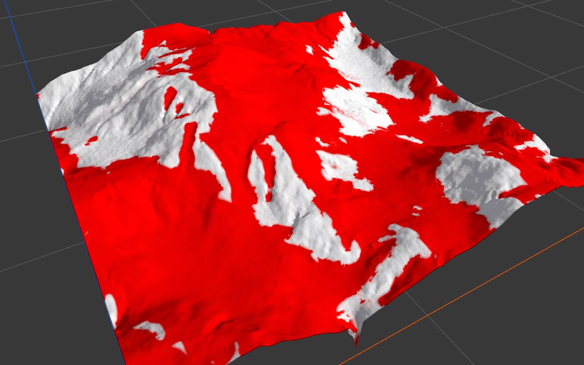 |
Light Dusting leaves steep and exposed ground bare. Winter Blanket and Himalayan cover nearly everything above the line; the difference is mostly in depth, which Coverage does not show. Wind Swept strips the ridges facing the wind into bare streaks.
Wind off

Wind Strength 0 (Alpine otherwise). Compared with the Alpine shot below, the ridges keep their snow and the edges of the bare areas are smoother.
Other masks (Alpine, Snow Line 150)
| Depth | Avalanche | Drift |
|---|---|---|
 |
 |
 |
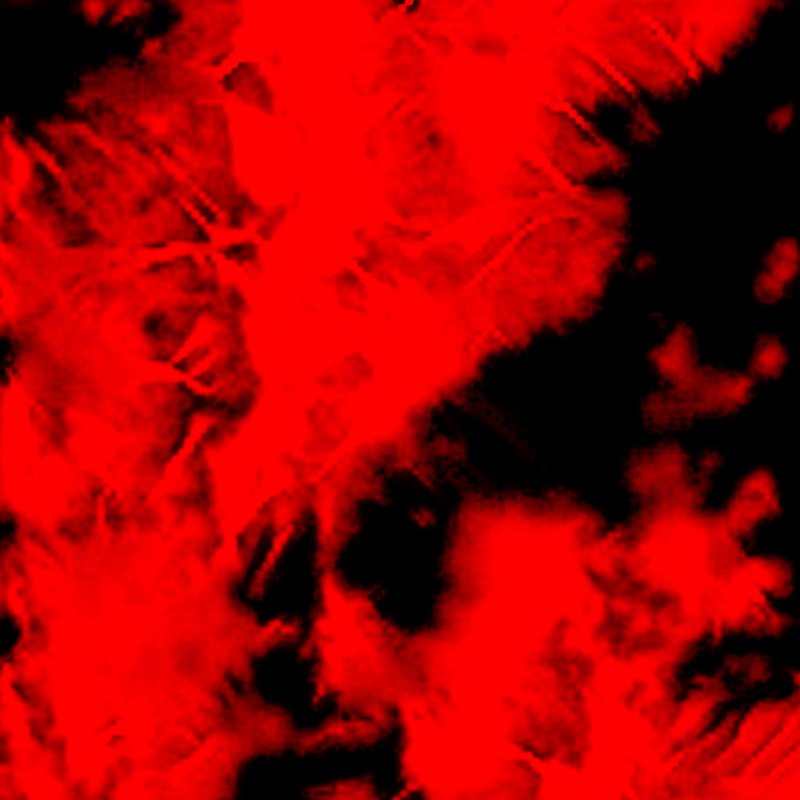
Depth is deepest in hollows and on gentle ground. Avalanche marks a few chutes down the steepest slopes; this eroded terrain has few slopes past the Repose Angle, so a steeper terrain shows many more. Drift marks the sheltered side of ridges, downwind of the 90 degree wind.
Recipes
- Snow and rock textures: Coverage → Layer 1 of Weight Blend with Layer 0 empty for rock; each output to a Texture Output, rock at order 0 and snow at order 1.
- Powder and crust: Depth → blend between two snow textures.
- Dirty chutes: Avalanche → a darker, rougher snow layer.
- Snowy mountain biome: Generic Mountain → Hydraulic Erosion 2 → Snow Fall 2 (Snow Line about a third of the terrain height) → Height Output.
Warning
Slopes decide most of the look, so the node needs the terrain's real height. Check that the Vista Manager's Max Height matches your terrains: at a low value, the slopes look gentle, almost nothing exceeds Repose Angle and Avalanche stays empty.
Tip
Depth stays dark when Depth Ramp is far above the snow that falls. Total snowfall is about Snowfall Rate × Iteration millimeters (4 m for Alpine); set Depth Ramp in that range.
Tip
Needle spikes steeper than Bare Angle hold no snow and read as bare rock. Soften the shape rather than raising Bare Angle far.
Note
Snow Line, Sun Bearing and Wind Direction are in world terms and are not set by the presets. Set Snow Line inside your terrain's height range and Sun Bearing to match the scene's light.
Performance
Heavy compared with most nodes: about 20 seconds for the Alpine preset on a 1 km biome in the editor. Feature Size sets the cost; its minimum is 4. Fine mask detail comes from the output resolution, so a smaller Feature Size barely changes the masks. Unchanged nodes load from the cache.
Related nodes
- Hydraulic Erosion 2, Thermal Erosion 3: shape the terrain before the snow.
- Flow: liquid running over the terrain, a sister simulation.
- Snow Fall: the older version, deprecated.
For AI agents
- Type name:
SnowFallNode2. Inputs: Height =0, Source =1. Outputs: Height =100, Coverage =101, Depth =102, Avalanche =103, Drift =104. - Properties:
iterationCount,useAutoIterationPerFrame,iterationPerFrame,featureSize(≥ 4),snowfallRate,snowfallOverTime,variation,snowLine(m),snowLineSoftness(m),meltRate,sunBearing,sunInfluence(m),windStrength,windDirection,windVariation,driftDistance(m),shelterDistance(m),windwardBias,reposeAngle,bareAngle,holdDepth(cm),runoutAngle,momentum,channeling,blanket,coverDepth(cm),depthRamp(cm),avalancheMin,avalancheMax,driftRamp(cm). - Runs over several frames: capture again until the stats stop changing (about 20 s for Alpine at 1 km).
- Measured on the sample at Snow Line 150: Coverage full on about 79% (Alpine), 61% (Light Dusting), 86% (Himalayan).