Geometry Blending
Geometry blending covers the three output families that shape the terrain surface: height, holes, and mesh density. Each has its own blend rule because they describe different things and have different compositing needs.
Select a Local Procedural Biome, then open Blending in the Inspector to find these settings.
Height Map
Height Map controls how the incoming biome's terrain height is combined with the height already produced by earlier biomes.
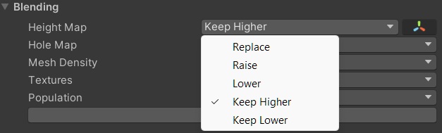
Height Map blend modes in the Local Procedural Biome Inspector.
| Mode | What it does |
|---|---|
| Replace | Transitions from the current height to this biome's height using the biome mask. |
| Raise | Adds this biome's height on top of the current height. |
| Lower | Subtracts this biome's height from the current height. |
| Keep Higher | Compares the current height and this biome's height and keeps whichever is higher. |
| Keep Lower | Compares the current height and this biome's height and keeps whichever is lower. |
Use Transform For Height Blend

The Use Transform For Height Blend option, found below the Height Map dropdown.
This option is enabled by default for newly created biomes.
With this enabled, moving the biome object vertically offsets its height output, and scaling it on the Y axis amplifies or reduces that output. This makes it easy to match the height level of one biome against another directly in the scene, without opening the graph.
Replace
Replace is the standard blend mode for most biomes.
The biome's anchors define the area where this biome takes over the terrain height. The falloff anchors control how gradually the height transitions at the edge of that area. Inside the anchors the terrain fully takes this biome's shape. Outside the falloff the terrain keeps what earlier biomes produced. Between the two the height blends proportionally.
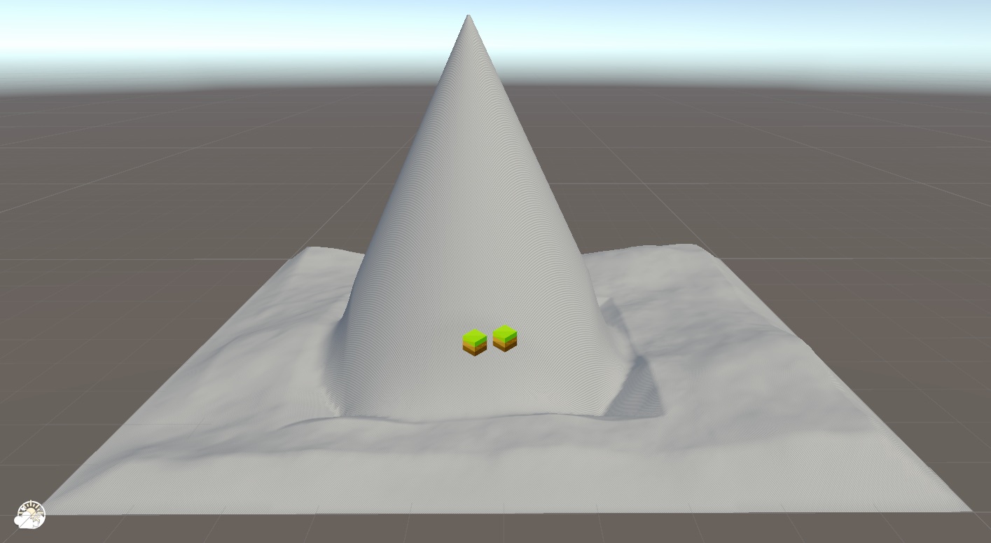
Without Use Transform, the biome's vertical position is ignored during blending.
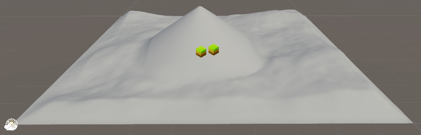
With Use Transform, moving the biome up shifts its height output to match the surrounding terrain.
Good for:
- base biomes that define the main landscape
- regional biomes that transition softly into surrounding terrain
- almost any biome that is meant to own its area
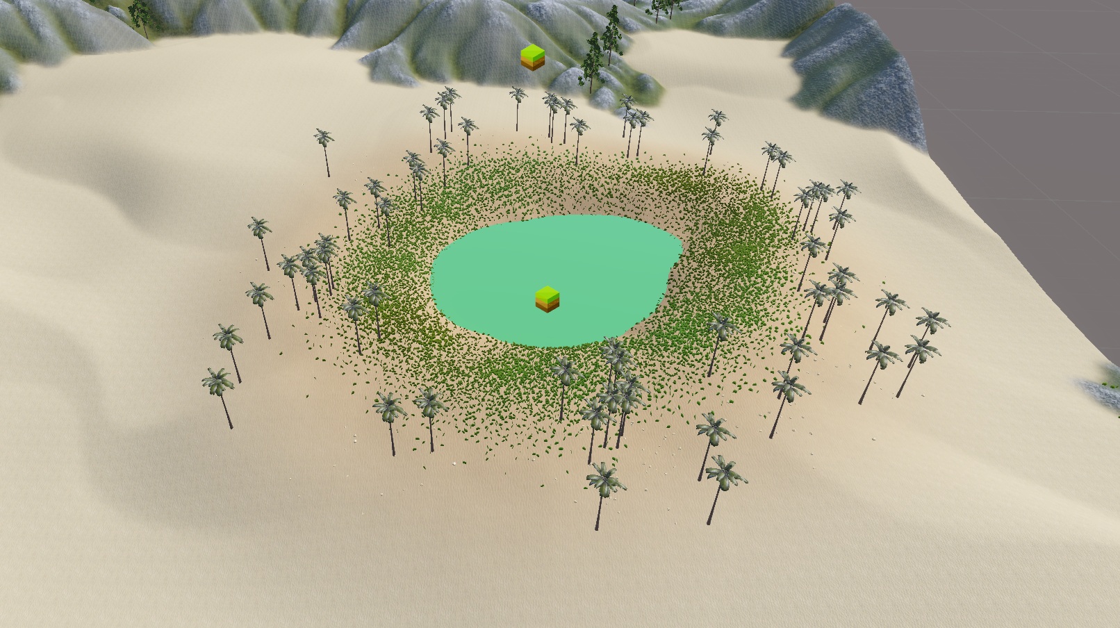
An oasis biome using Replace. The falloff anchors produce a soft height transition into the surrounding dunes.
Raise
Raise treats this biome's height output as an additive layer on top of whatever the terrain already has.
The anchors define where the height is added. Inside the anchors the full height is added. Toward the falloff anchors the contribution fades out gradually.
Good for:
- a burial mound, earthwork, or dirt pile sitting on top of a field
- a raised road embankment or levee running across flat ground
- rolling hills added on top of a base plateau
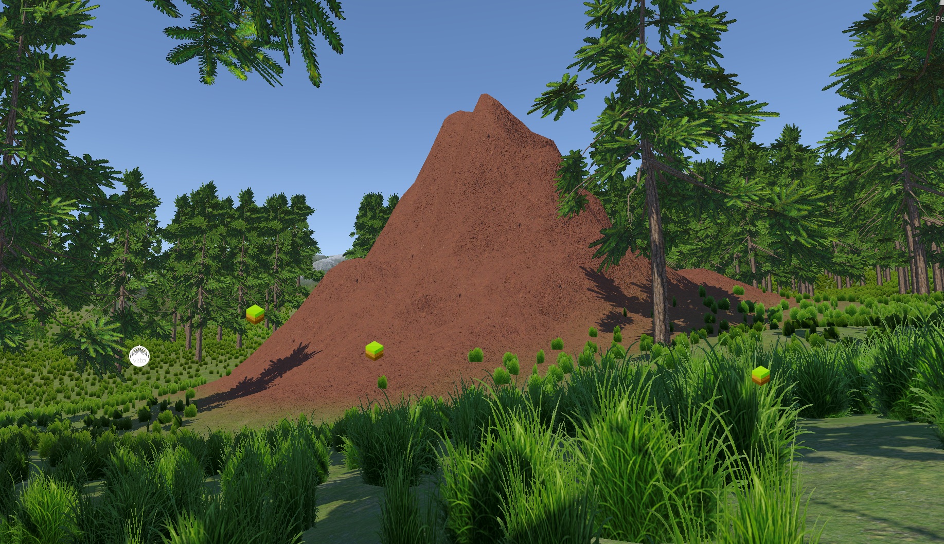
A mound of earth biome using Raise. The height is added on top of the existing terrain within the biome's anchor area.
Note
Raise does not compare heights. If the biome has a flat output of zero, raising it has no visible effect. If the biome outputs negative height, Raise can also push the terrain down.
Lower
Lower subtracts this biome's height from the current terrain, using the biome mask to control the strength of that subtraction.
Good for:
- a river channel or dry creek bed carved into the terrain
- a basin sinking below the surrounding ground
- a trench or moat dug into an otherwise flat surface
Note
Lower and Raise are both additive operations, just in opposite directions. Neither one looks at what the other biome produced. If you need the incoming biome to win only where it is actually below the terrain, use Keep Lower instead.
Keep Higher
Keep Higher first multiplies this biome's height by the biome mask, then compares the result against the current blended height and keeps whichever is higher.
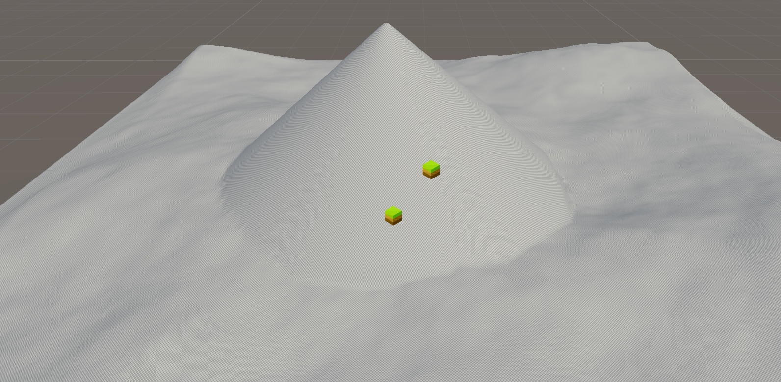
Keep Higher multiplies the biome's height by the mask, then keeps whichever value is higher between that result and the current terrain.
Good for:
- a mountain or hill that should always rise above the surrounding terrain
- a cliff formation that overrides lower ground
- filling a hollow, valley, or depression with sediment or sand up to a certain level, leaving higher ground untouched
- any feature that should appear only where it is elevated above the base
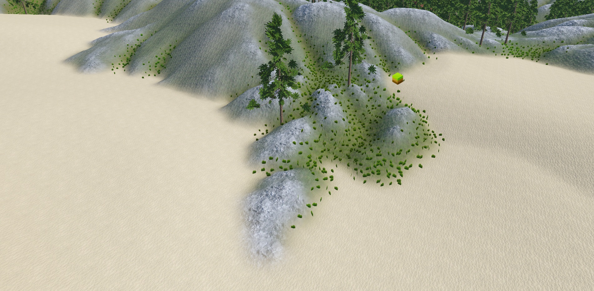
A dunes biome using Keep Higher to fill the hollow areas of a mountain. Sand accumulates in the low points while the mountain peaks remain untouched.
Tip
Keep Higher pairs naturally with Height Win on the Textures and Population blend options. This lets surface textures and placed objects follow only the parts of the biome that actually rise above the terrain.
Keep Lower
Keep Lower first multiplies this biome's height by the biome mask, then compares the result against the current blended height and keeps whichever is lower.
Good for:
- a crater or impact basin that should always sit below the surrounding terrain
- a river valley that carves the lowest possible surface
- a cave mouth depression that must stay below the ground level around it
Tip
Keep Lower pairs naturally with Height Win on the Textures and Population blend options, the same way Keep Higher does. This lets crater floor textures and interior objects follow only the lowered area.
Common mistake
Unexpected shelves, spikes, or abrupt transitions are usually caused by height values that are too large, not by the wrong blend mode. Before changing the blend mode:
- Reduce the biome's Y scale in the scene to quickly pull the output down without opening the graph.
- Or adjust a Levels node to scale the Height Output inside the graph.
Hole Map
Hole Map controls how terrain holes from the incoming biome are combined with the current hole result.
| Mode | What it does |
|---|---|
| Replace | This biome controls the holes in its anchor area, replacing what earlier biomes produced. |
| Max | Holes from any biome are preserved. A pixel becomes a hole if either side marks it as one. |
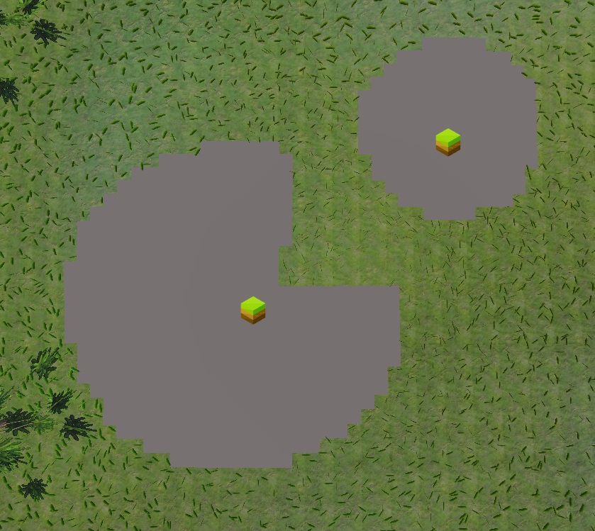
Replace: this biome takes full control of the hole pattern inside its anchor area.
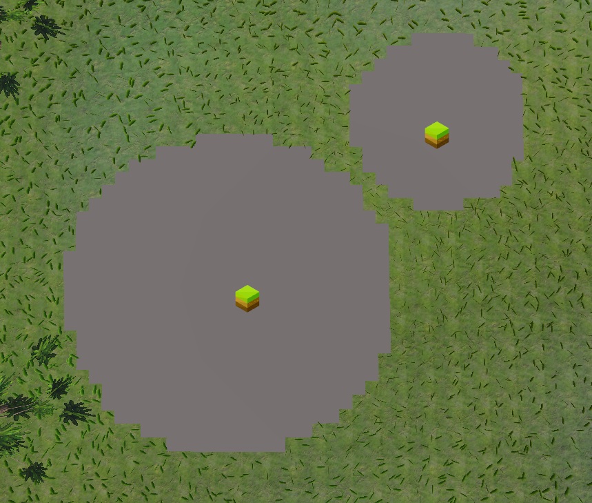
Max: holes from multiple biomes are all preserved, none overwriting the others.
Mesh Density
Mesh Density is a Polaris Terrain feature. It controls how the incoming biome changes the polygon density of the Polaris terrain mesh.
If your project uses Unity Terrain, this channel has no effect and you can ignore it.
| Mode | What it does |
|---|---|
| Replace | Transitions from the current density to this biome's density. |
| Add | Adds this biome's density on top of the current density. |
| Subtract | Reduces the current density by this biome's density. |
| Max | Keeps whichever density is higher between the current and this biome. |
| Min | Keeps whichever density is lower between the current and this biome. |